The day in walk: Bridges 2: winter riverfront
January 17, 2011
Today I was supposed to pick someone and follow them for a while, reporting on where they went. Well, I followed Old Man River and he went south, to New Orleans.
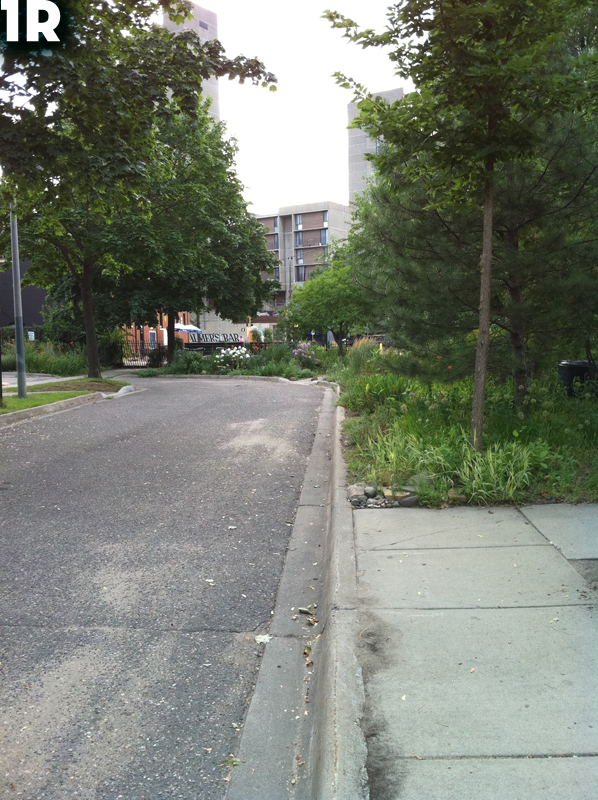
I was going to take pictures of the river (the Mississippi River in downtown Minneapolis)—the river itself—but it didn’t take long at all for my focus to shift to the bridges. The river is present in a few of the shots, but once again the underneaths of the bridges are the stars. Maybe you remember when I did that last summer on a bike ride.
Ah, summer.
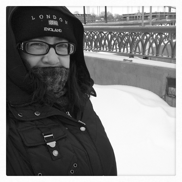
The difference between last summer’s bike ride and today’s walk is, oh, I don’t know, about 70°F/21°C. I didn’t look today, but it was about 15°F/-9°C, based on the forecast high. But being a hardy Minnesotan, I bundled up and went for a nice walk.
So.

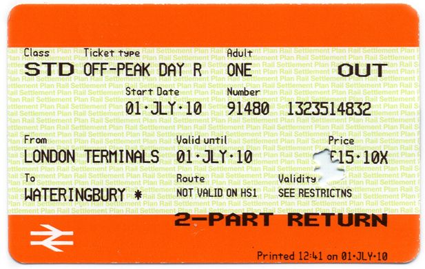
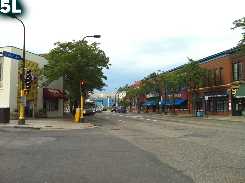
1. Hennepin Avenue Bridge (historic). Underneath the bridge, behind where I stood to take my photo, are a couple of pylons from the original version of this bridge built in the mid-1800s. I think the current bridge is the third or fourth version. Oh. According to Wikipedia, this bridge was the first permanent one across the Mississippi River. How about that?

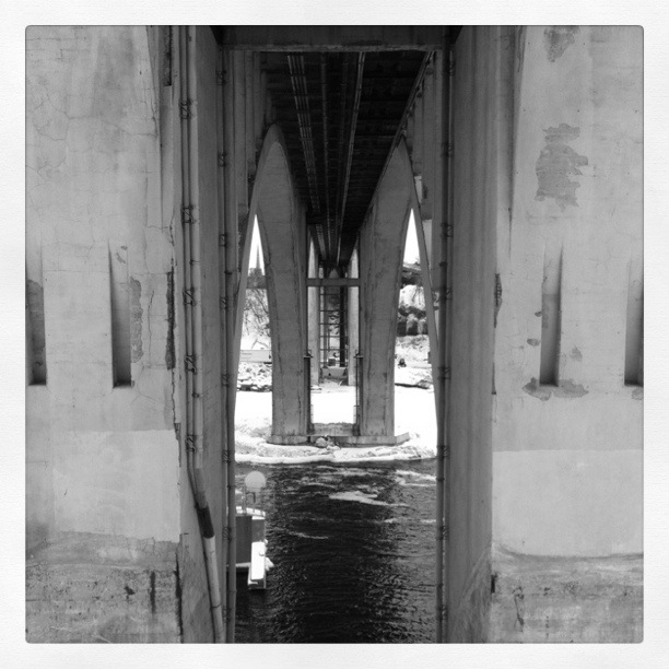
2. 3rd Avenue Bridge (secret passage). Just a bit east (the whole walk wasn’t even two miles), is a more modern-looking, but quite older bridge. This one was an odd duck because it has beautiful arches when viewed from a distance. But when you’re standing directly underneath it, all you see are two doorways like the one in this photo. It looked like it went through three parallel walls. Weird. I was sort of disappointed there wasn’t a drawbridge or something.
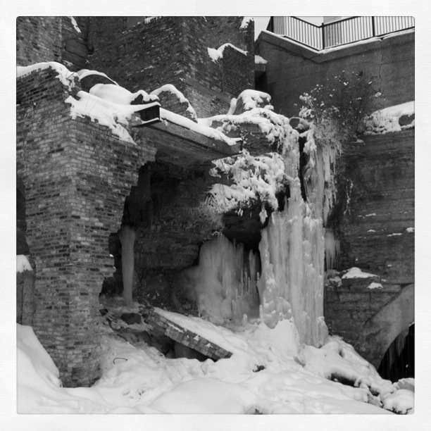
3. Mill Ruins Park. Okay, so it’s not a bridge, it’s the riverfront ruins of abandoned flour mills. There is running and dripping water everywhere. The icicle mass was cool. There also seemed to be a model photoshoot going on. The models were not modeling outerwear. Silly catalogs.

4. Stone Arch Bridge (arches). This is the bridge that might possibly have some notoriety outside the Twin Cities. It used to be a railway bridge. Now, it is for pedestrians and bicyclists. It’s stoney and archy and neat. It’s at the foot of the St. Anthony Lock & Dam, which I believe is the first lock and dam on the Mississippi. The first in sequence, I mean. I don’t know if it was the first constructed.
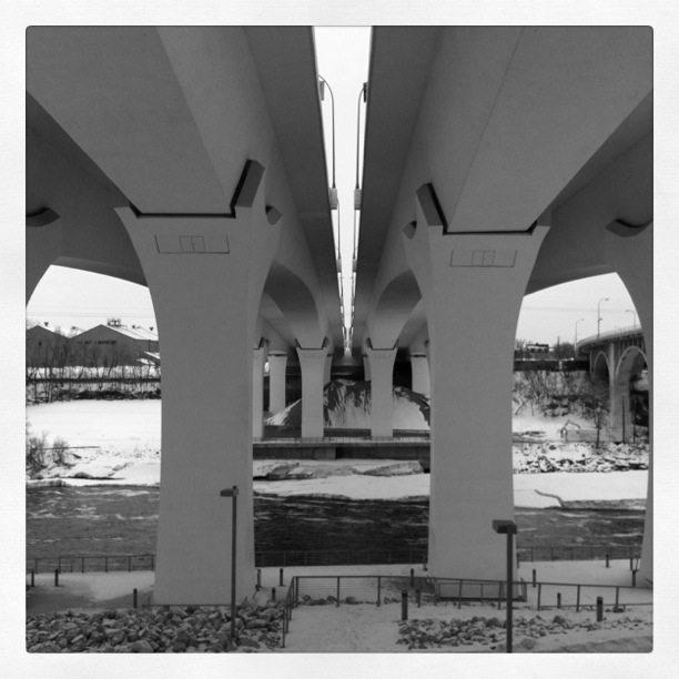
5. I-35W Bridge (strong). This is the sturdy replacement for the bridge that collapsed in 2007. From the side you see graceful arched spans, and from underneath you see these stout legs. I live in the neighborhood. I was outside puttering with my tomato plants when the old bridge collapsed. I heard the sirens and figured there was a big accident on I-94, which is also near my home. It’s still weird to interact with the new bridge.
6. 10th Avenue Bridge (industrial). It’s also weird to be underneath this bridge, just a couple blocks downstream from the 35W Bridge. This photo doesn’t show it, but this bridge looks old and tired from below. The roadbed on top is all spiffy, but it’s a little creepy to look at the chipping concrete when you know what happened to its neighbor three years ago.

Photos were taken with the assistance of my new friend, Instagram, and the Inkwell filter. (Except for the first one of me, that is. I did that in Photoshop.)
Gone to the Swan
December 2, 2010
I spent almost all of my time in London, but there was one side trip. Dan thought it would be fun to combine an outing to the country with tracking down one of the honorees on a top pubs list by the Guardian. That was Swan on the Green in West Peckham, Kent.
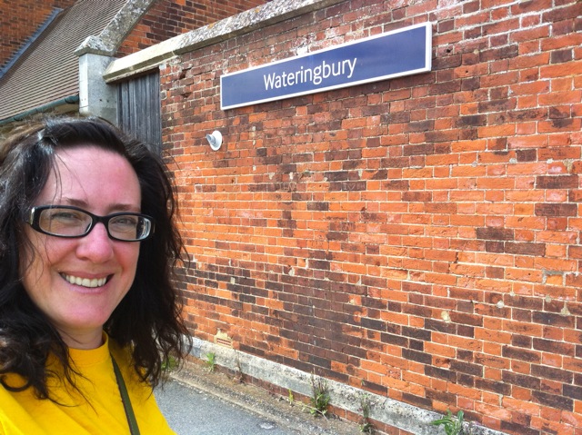

We took the train from London to Wateringbury. The Wateringbury station house was a charming old building with lots of interesting shapes and angles.
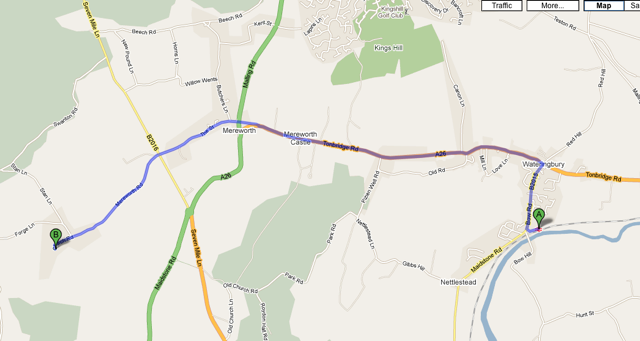
From there we had an about four mile walk to West Peckham and the Swan.

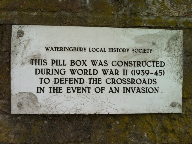
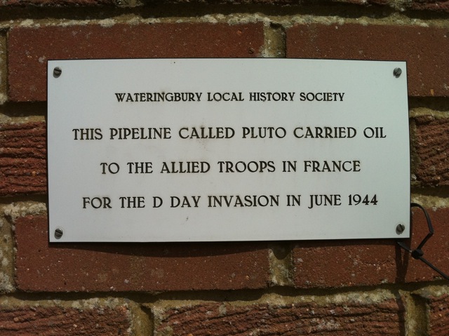
The town of Wateringbury seemed pretty typical. I noticed a few of these World War II plaques on walls along the road. Other than Ground Zero in New York City, we don’t really have physical battlefields on the continental United States from recent times, so I thought they were pretty interesting. Most of my knowledge of the war comes from television programs like “Foyle’s War.” It was a little eerie in a way seeing these markers of people’s pride in their war effort, and definitely humbling to see firsthand evidence of something I only know through Hollywood representations.

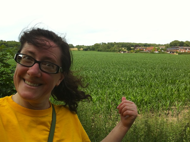
We walked on. This was pretty typical of my view—Dan and Casper way ahead. I thought I was a fast walker, but Dan walks really fast. I didn’t always bother to holler that I was stopping to look at something and take pictures, like when, being the Midwestern girl that I am, I got a kick out of hey, they grow corn here, too!

Along the way, we thought we’d stop at Mereworth Castle and have a look around. As we approached the “castle,” which was really just a large manor, a woman came running out and inquired, rather suspiciously and in a thick Slavic accent, what we were doing there. We learned that it was a private residence not open to the public and beat a hasty retreat back to the main road. Instead, I settled for taking what turned out to be my favorite photo that I’ve taken so far on my iPhone 4 of roses in the yard of the church in the town of Mereworth. I love the colors and the blown-out exposure of the background.

Mereworth is also where we crossed a street named, appropriately enough, The Street. That tickled my funnybone.
We continued to walk without incident, except for Casper’s alarming tendency to occasionally drift out into the road, until we reached West Peckham. We triumphantly strode up to the Swan on the Green, ready for a tasty beverage to refresh us after our walk, only to find that they were closed until suppertime. Anticlimax.

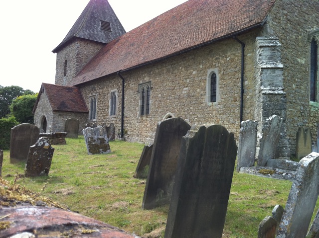
Casper set up watch and we endeavored to kill over an hour, which included playing backgammon and exploring the neighboring church yard.
Casper talked us into a few ball sessions on the eponymous green across from the pub until, at last, it was once again open for business.


We were excited because we knew they made their own beer. I always enjoy sampling new and local brews when I go places. By that time we were also famished and enjoyed a nice meal.


It was soon time to go, though Dan determined that we were a little too late to catch the last train back to London from Wateringbury, so when we got back as far as Mereworth (approximately), we went to The Queen’s Head Pub (StreetView), whose sign we had seen on the main road, and called a cab to take us somewhere else—to Tonbridge, I think (correct me if I’m wrong)—to catch the train from there. We had just enough time for one more thirst quencher while we waited for our ride.
It was almost a disaster—the cab driver informed us that dogs were not allowed, but we didn’t have to work too hard to convince him otherwise. It seemed like the car ride to Tonbridge took as long as the whole train ride down had earlier in the day, but at last we were speeding toward home. We were all quite pleased when we arrived back at the house.
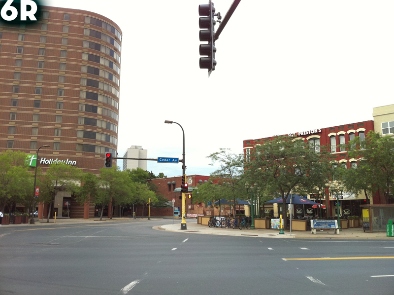
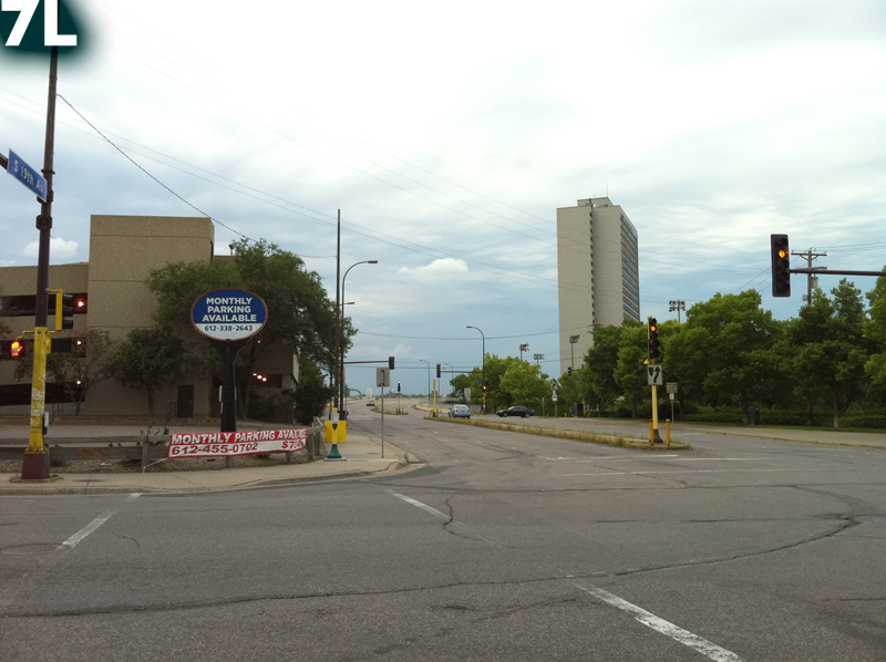
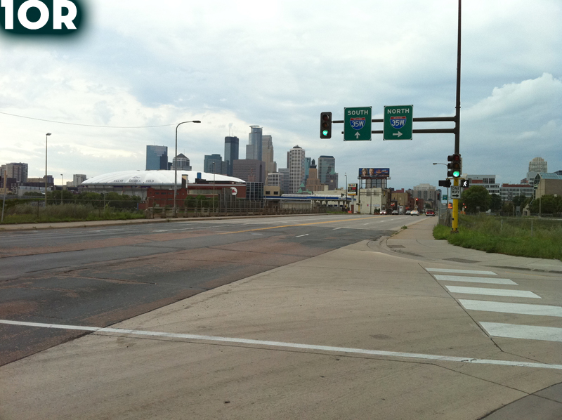
The day in walk: coin flip walk, July 31, 2010
August 4, 2010
Here’s a great way to explore: flip a coin. If it’s heads, go left. If it’s tails, go right. Do this an arbitrary number of times and set off. I did it ten times and walked. My route was RLRRLRLLLR.
I didn’t censor the coin’s choices. My only stipulation was that to make a turn, both left and right had to be available. I live in an area where two interstates junct and major roads intersect, so sometimes there’s only one way to go, as happened in between flips 4 and 5.
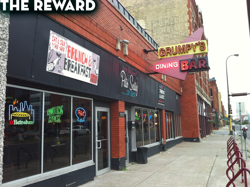
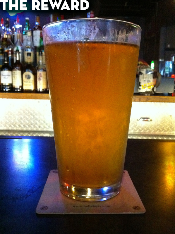
So here then is my walk. Each photo is at the corner looking in the new direction. It is a happy coincidence minus preplanning that my last turn set me in the direction of one of my favorite bars which was only a couple blocks further. What could I do but go have a beer (a delicious Bell’s Oberon)?


July 31, 2010
