The day in walk: Bridges 2: winter riverfront
January 17, 2011

Today I was supposed to pick someone and follow them for a while, reporting on where they went. Well, I followed Old Man River and he went south, to New Orleans.
I was going to take pictures of the river (the Mississippi River in downtown Minneapolis)—the river itself—but it didn’t take long at all for my focus to shift to the bridges. The river is present in a few of the shots, but once again the underneaths of the bridges are the stars. Maybe you remember when I did that last summer on a bike ride.
Ah, summer.
The difference between last summer’s bike ride and today’s walk is, oh, I don’t know, about 70°F/21°C. I didn’t look today, but it was about 15°F/-9°C, based on the forecast high. But being a hardy Minnesotan, I bundled up and went for a nice walk.
So.

1. Hennepin Avenue Bridge (historic). Underneath the bridge, behind where I stood to take my photo, are a couple of pylons from the original version of this bridge built in the mid-1800s. I think the current bridge is the third or fourth version. Oh. According to Wikipedia, this bridge was the first permanent one across the Mississippi River. How about that?

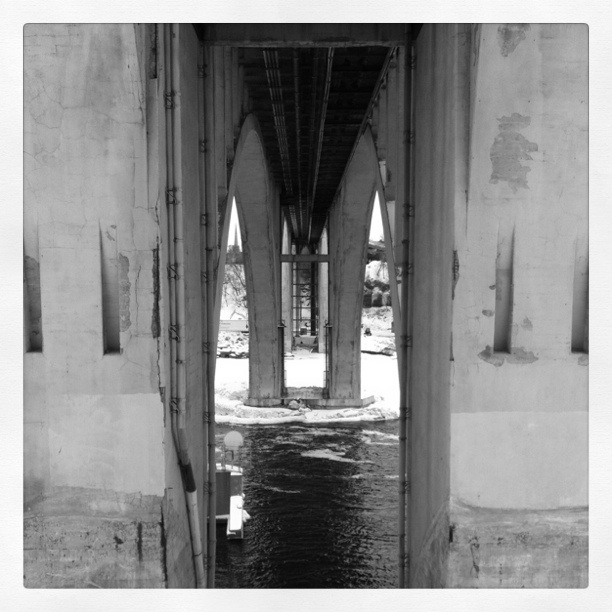
2. 3rd Avenue Bridge (secret passage). Just a bit east (the whole walk wasn’t even two miles), is a more modern-looking, but quite older bridge. This one was an odd duck because it has beautiful arches when viewed from a distance. But when you’re standing directly underneath it, all you see are two doorways like the one in this photo. It looked like it went through three parallel walls. Weird. I was sort of disappointed there wasn’t a drawbridge or something.
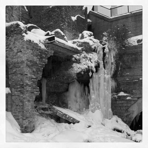
3. Mill Ruins Park. Okay, so it’s not a bridge, it’s the riverfront ruins of abandoned flour mills. There is running and dripping water everywhere. The icicle mass was cool. There also seemed to be a model photoshoot going on. The models were not modeling outerwear. Silly catalogs.

4. Stone Arch Bridge (arches). This is the bridge that might possibly have some notoriety outside the Twin Cities. It used to be a railway bridge. Now, it is for pedestrians and bicyclists. It’s stoney and archy and neat. It’s at the foot of the St. Anthony Lock & Dam, which I believe is the first lock and dam on the Mississippi. The first in sequence, I mean. I don’t know if it was the first constructed.
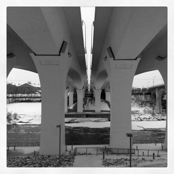
5. I-35W Bridge (strong). This is the sturdy replacement for the bridge that collapsed in 2007. From the side you see graceful arched spans, and from underneath you see these stout legs. I live in the neighborhood. I was outside puttering with my tomato plants when the old bridge collapsed. I heard the sirens and figured there was a big accident on I-94, which is also near my home. It’s still weird to interact with the new bridge.
6. 10th Avenue Bridge (industrial). It’s also weird to be underneath this bridge, just a couple blocks downstream from the 35W Bridge. This photo doesn’t show it, but this bridge looks old and tired from below. The roadbed on top is all spiffy, but it’s a little creepy to look at the chipping concrete when you know what happened to its neighbor three years ago.

Photos were taken with the assistance of my new friend, Instagram, and the Inkwell filter. (Except for the first one of me, that is. I did that in Photoshop.)

January 17, 2011 at 9:52 pm
I love walking along there.