
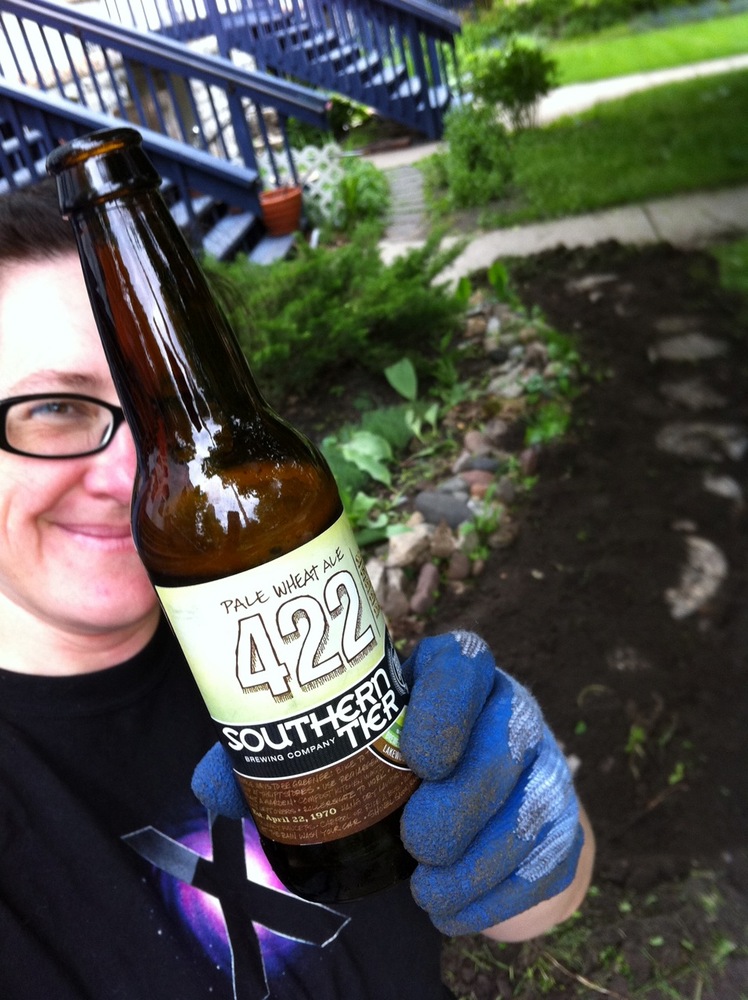
Last Saturday, all I was planning to do was ride my bike the ten minutes to the nearby Midtown Farmers Market, eat the farm egg sandwich with asparagus pesto, greens, maple vinaigrette, and Parmesan that the Dandelion Kitchen food truck was making, and bike the ten minutes back home. No such luck. The weather, though slightly on the warm side for my personal preference, was simply wonderful and I couldn’t help but stay outside.
This was my first time visiting this particular market. I go anywhere on Saturday mornings, it has been to the Mill City Farmers Market to visit another favorite food truck, Chef Shack. But this Saturday, Dandelion Kitchen’s tweet about that egg sandwich caught my eye and I thought, why not? I’ve often enjoyed their lunch creations downtown during the work week and I was excited to try something different.
It was delicious. I bet they’d sell a lot of those egg sandwiches at lunch, too.

There were a few other food stands at the market, so I went back for more. I decided to also try the Caprese kebab and the curry satay chicken from Kabomelette. I don’t know how I was expecting the Caprese to be prepared—I guess as a kebab I was thinking it would be hot—but it was the only thing it could have been—mozzarella balls and grape tomatoes on a skewer. I think those fresh mozzarella balls might be one of my favorite forms of cheese. The curried chicken was quite good, too.
I will try the other food stands the next time I go back.
When I finished eating, I had a ten-second debate with myself about whether to take the long way home, aka, do the ten-mile bike ride loop. It was a debate because I hadn’t packed my bike the way I would if I planned to be out for a while; in the end, I knew that if I went home to re-prepare I probably wouldn’t go back out, so away I went south instead of north.
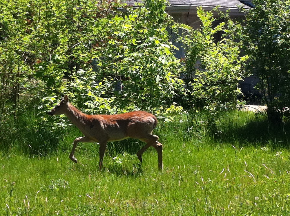
I was rewarded within a mile. As I approached the corner of Hiawatha Avenue and 46th Street where the bike trail jogged off into a less-concretey setting, a young deer came trotting out of the brush looking as if it had a mind to cross Hiawatha. I was able to cross 46th quickly enough that I could shoosh it back to where it had come from. A few yards on and I could still see it between the road and the nearby houses.
I went off-road and stalked it gently to see if I could get some pictures. It was obviously an urban deer because it didn’t seem too concerned by me. We had a few stare-downs and I could see that it was a young buck with about six-inch antler sprouts. He eventually waggled his tail at me and sauntered back into the undergrowth and I decided it was time to move along.
My loop took me through Minnehaha Park. After dilly-dallying at the market and communing with the deer, I found myself in need of facilities and availed myself of the some in one of the pavillions. When I came back out, I noticed that Minnehaha Creek was flowing more energetically than I’m used to seeing it when I ride east from Hiawatha. I let myself be hypnotized by what could be considered mini-rapids and walked my bike along the bank for a ways. I came to a footbridge over the creek and went up on it. I looked over the other side and suddenly realized that I had accidentally come upon Minnehaha Falls.
No kidding, that’s the first time I’ve ever been to the falls in person in the twenty total years I’ve lived in Minneapolis which is just crazy. It’s a landmark location. For the second time in the day, I made the decision to take my time. I locked my bike up and explored, along with a hundred of my closest friends.
Doesn’t matter that there were crass people and screaming kids all around me. Doesn’t matter that to go down and then back up, I had to negotiate about three storeys’ worth of short, stone steps. Sometimes, the aesthetics still win.
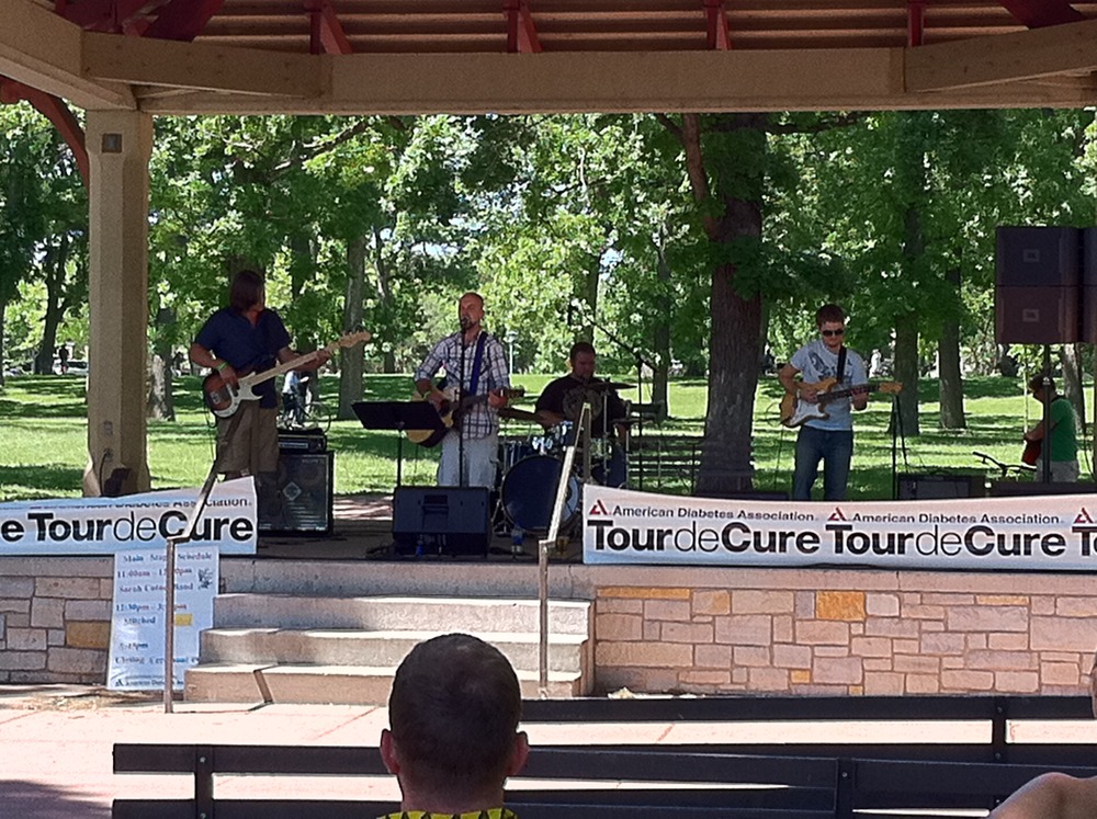
I found out that the hoard of other bikers I was seeing on the trail, most of whom had little number tags pinned to their backs, were participants in the Tour de Cure for diabetes, the finish line of which was in the park. As part of the festivities, the cover band Stitched was playing. I sat and listened their interesting range songs, which included Bon Jovi’s “Wanted Dead or Alive” and the Ohio Players’ “Love Rollercoaster.” I liked the guy’s voice.
I finally got going again and went my merry way north along the Mississippi River. When I got near the end I decided that I was too hot and tired to deal with the long, steep hill that I knew awaited me to get up from the river back onto the streets in my neighborhood, so I peeled off into the side streets which were a little less direct but much more flat.
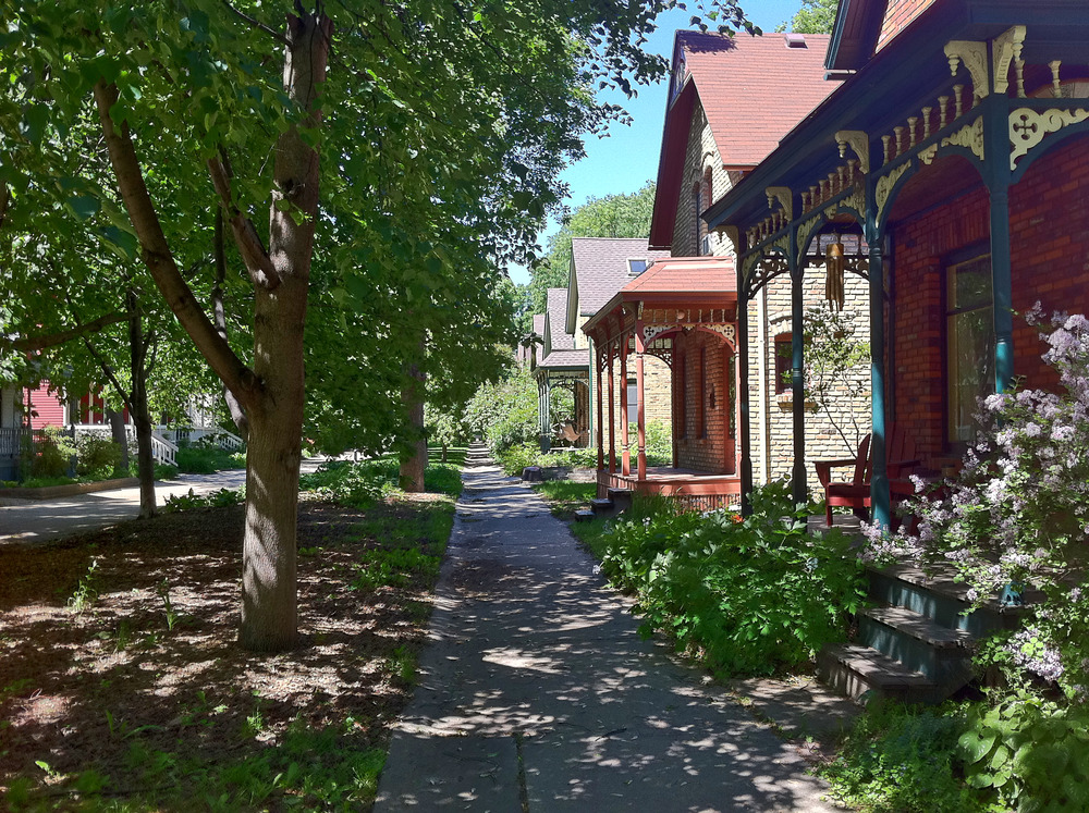
As a result, I was able to ride through the Milwaukee Avenue Historical District, a charming example of urban preservation. The houses were built in the late 1800s and rehabilitated in the 1970s. The street was turned into a pedestrian mall and when you walk (or bike) along it, you totally have the feeling of being in another era.

I got home and realized for the first time in the nearly four hours that I had been out that oh yeah, it was sunny and I hadn’t put on sun screen because I had only been planning to be out in it for twenty minutes. Fortunately, it never felt as bad as the crisp to which it looks like I’m fried here. Still, it was shocking when I first saw it.
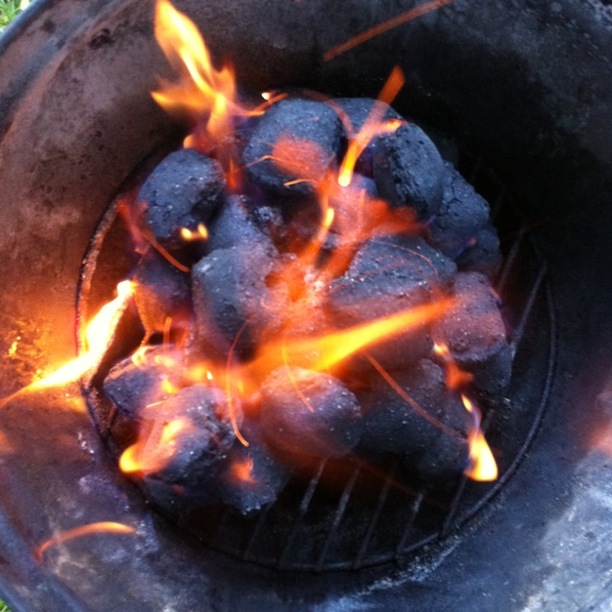
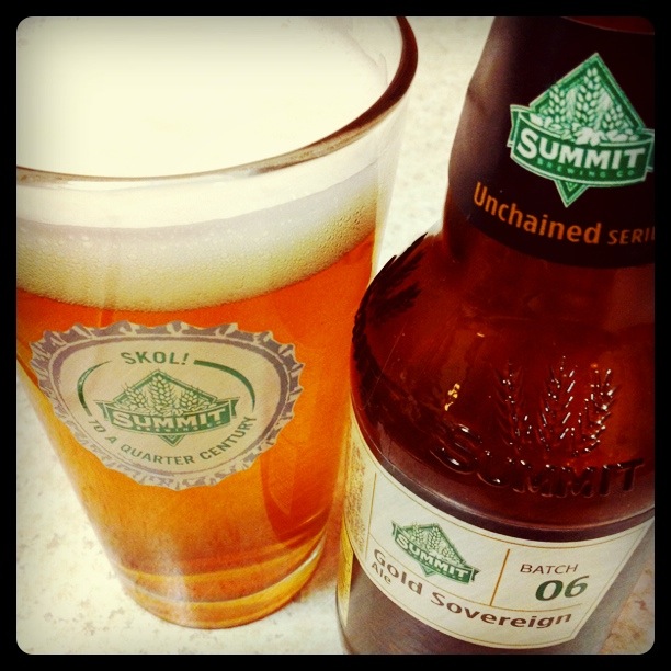
I showered and refreshed myself, built a fire with which to cook, and enjoyed a few Summit Gold Sovereign Ales while sitting on my steps. All in all, I consider it to have been one of the most enjoyabledays—partly because it was ninety percent spontaneous—I’ve had in the last few years (London vacation last summer notwithstanding). Hurrah!
The day in yard project: Garden pathway
May 30, 2011
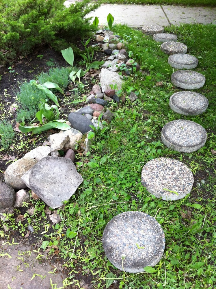
So for five years I’ve had these round pavers, languishing in stacks in front of my place, waiting for the whim to overtake me to make them into a path. My new upstairs neighbor bugged me all last summer to do it and I coyly demured. The last thing I want is to be told when to do something, or for it to seem like I’m doing something because somebody suggested it. Today, I finally got in the mood naturally and, thankfully, without any helpers.
Our section of yard was the only one without some sort of little path. Five summers ago I lugged home nine round stones from Home Depot. I wasn’t ready to actually labor that day so I set them aside and there they stayed. I originally measured taking into account having space in between each one. Soon after I decided I didn’t want space between them. I never went back to buy the two or three extra stones. But in the intervening years, I’ve found two flat, square pieces of concrete or something that will do.
Yesterday, the bug nudged its way into my pants and I laid the stones out. At work I’m doing a book about gardening and one of the tips for making pathways is to lay the stones down and let them kill whatever’s underneath so you’ll know how much space to clear. I put them down, pretty sure that I was just going to dig everything up. I don’t want grass in between.
Today, I grabbed the hoe and went to it. I was quite pleased indeed that it didn’t take long at all to dig up the grass, less than an hour. However, a little while later, my thumbs of all things got tired from the impact of all the hoeing. Even now, they’re feeling pretty weak. Nevertheless, the speed with which I cleared the grass kept me enthusiastic about the project.
I had a supervisor (Dasie).
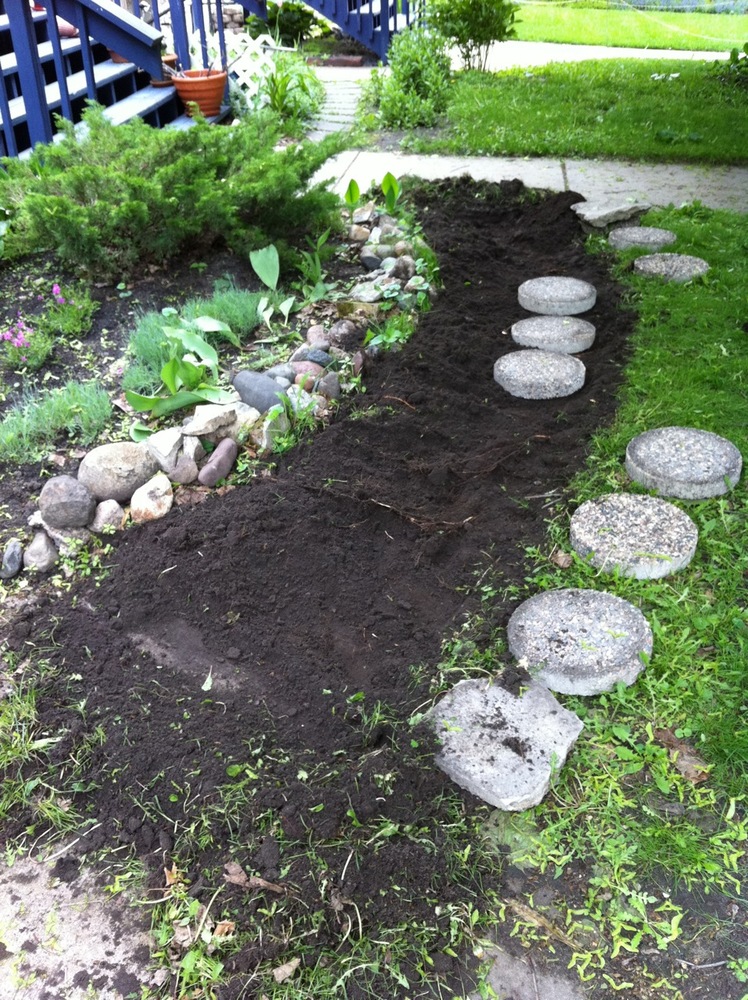
After I started embedding the stones in the dirt and it became apparent that the rest of the job would not go as quickly, I broke out the beer.

After about three hours, the stones were fairly snugly set with dirt repacked around them. The trouble with the project that you can’t see is that the stones kind of rise and fall due to unhackable large roots of the maple tree in the yard. There were two. I straddled one, but a stone had to sit on the other one to maintain the spacing. Oh well.

Then I decide that another phase of the project needed to be moving the little rock border forward. So I did that. Then I decided, after four hours, that I was done for the day. Or rather, my body decided for me. I think I’ll get some impatiens to put in the newly-vacated space.
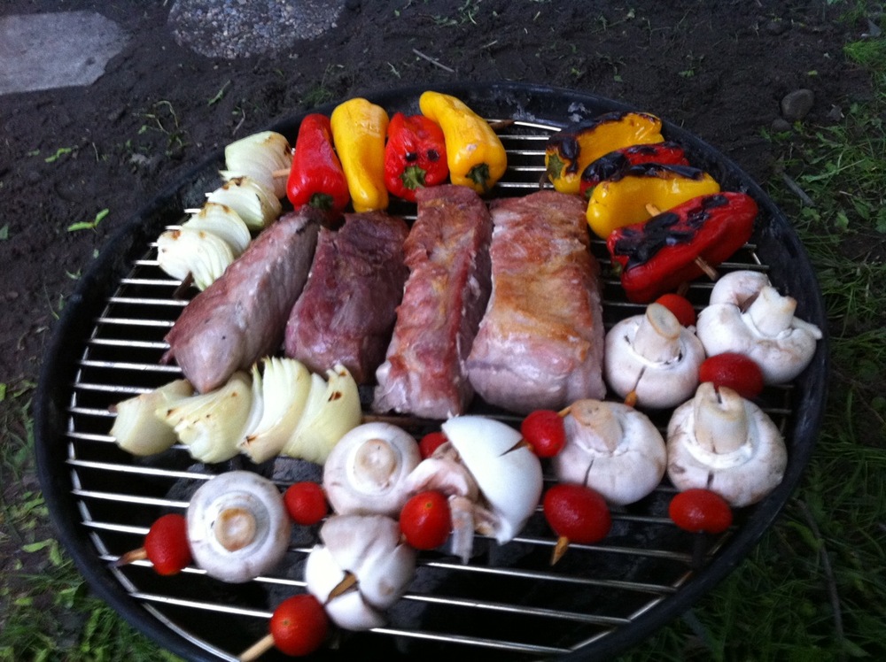
I had planned to wait to grill until tomorrow, but it suddenly seemed like a good idea. I had package of pork country style ribs thawed and ready to go.
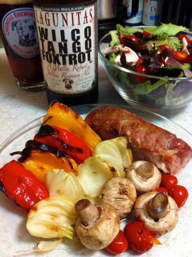
It was a good decision. It was a delicious meal with which to reward all my hard work. I was, however, a little concerned that I wouldn’t be able to move again once I sat down.

I took some ibuprofen eventually and that really helped. But then I got the best comfort (CJ)!
The day in winter: Tree fractals, part 3
March 10, 2011
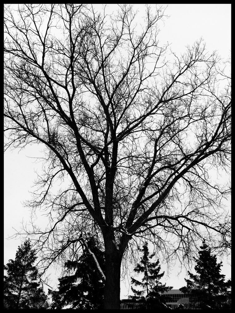
My online friends might have noticed that I’ve been obsessing over winter’s bare trees in the last week or so. I have become fascinated with imagining the root system underground that’s comparable to the naked branches I see reaching toward the steel grey winter sky. I just think these trees are stunningly gorgeous in their seeming randomness that’s actually well-behaved fractal growth.
Large trees and small trees, they all inspire me with awe. These urban trees quite often are given very precise plots in which to grow, defined by the 3-foot by 3-foot metal grates that mark their entrance into the earth. But Mother Nature endows them with persistence.
Here is my tribute to these wonderful plant creatures. They all exist within the linear mile and three quarters between my office in the heart of downtown and my home neighborhood that’s only slightly less in the thick of things.
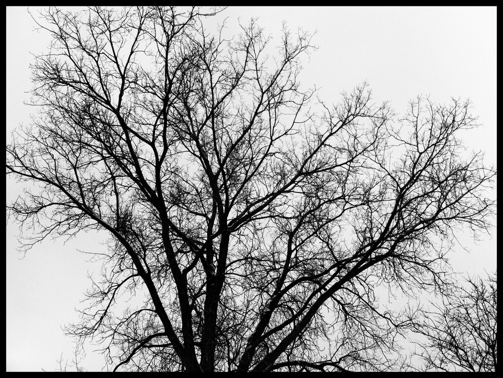
The tree at the very top and the tree directly above are, in fact, the same tree. I thought the vertical shot had nice composition, but the horizontal photo really shows off the branches.
All of the trees have their own personalities. The ones below I also found particularly appealing and beautiful. Each shows its own history. Maybe it has fortunate wind blockage from nearby buildings and can grow straight. Maybe it doesn’t and lists to one side. Maybe it’s in a healthy location and has grown an even crown of branches. Maybe it has to eke out a living on a dirty, busy, polluted corner and makes gasping grabs toward the sun.
If you are in a deciduous winter, go outside and revel in the beauty that has yet again been provided you by this planet we live on.

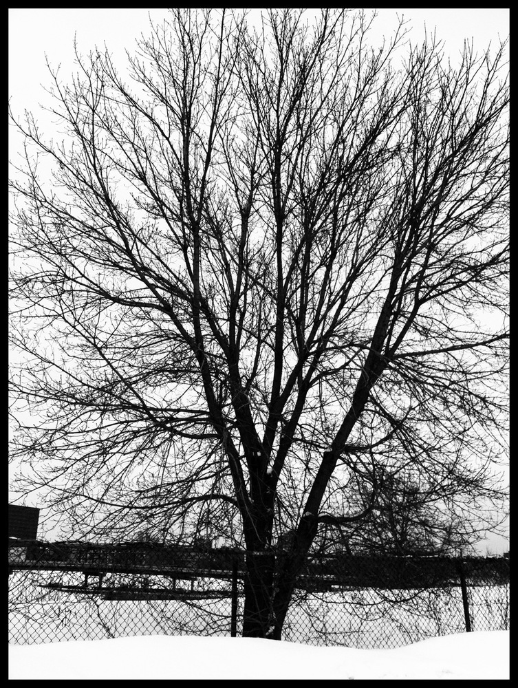
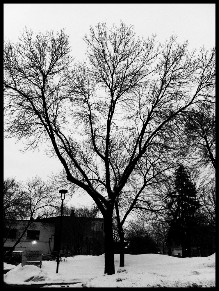
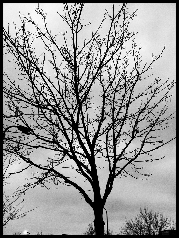
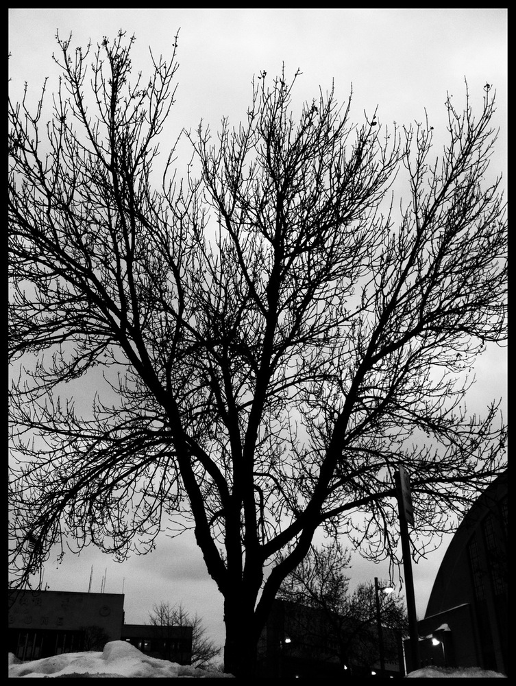
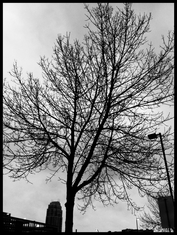
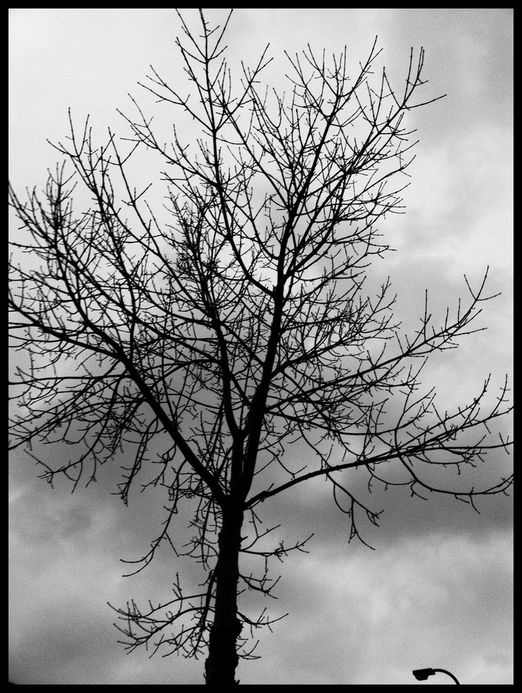
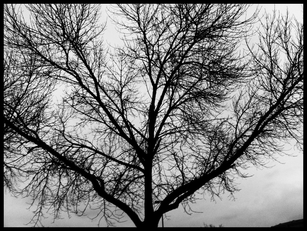
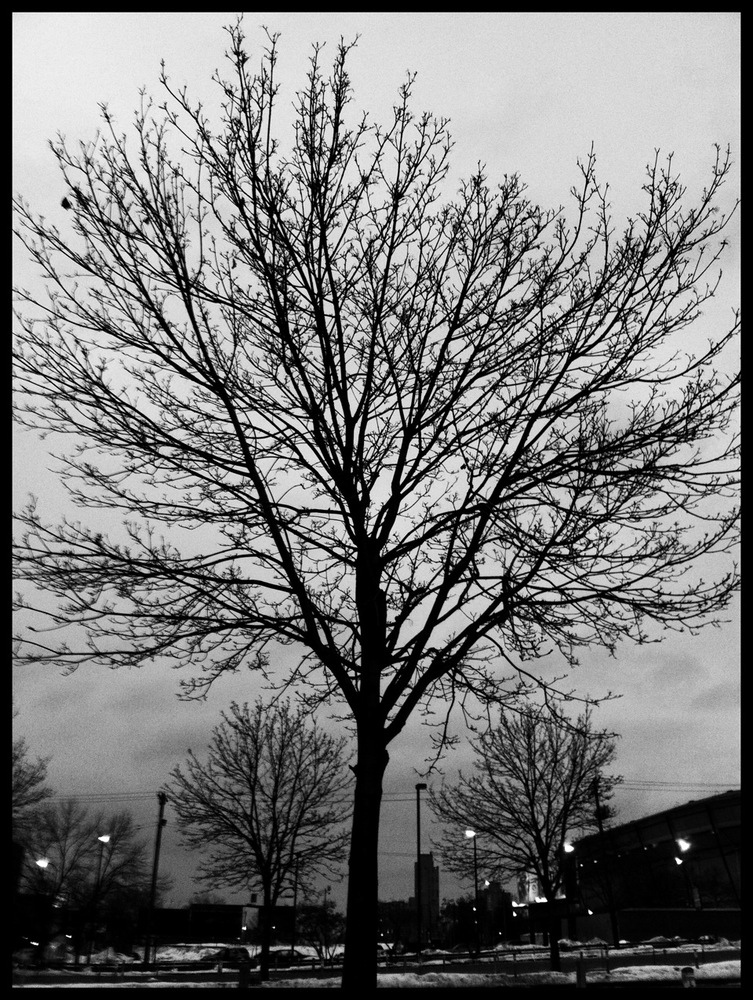
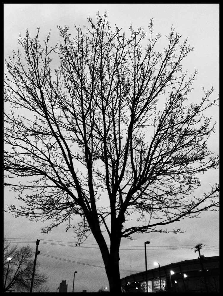
Photos were shot as dusk approached with my iPhone 4 and processed with Camera+ app, using the Ansel filter and thin black border, because today’s mission was to share a black and white photo.
The day in snow: Blizzard roadtrip!
February 21, 2011
Part 1: Back story
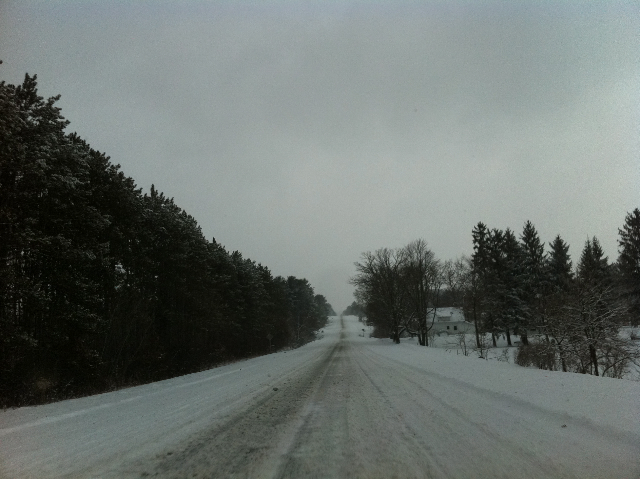
I have a good reason. My friend Sara and her podcast partner Rob from How Much Do We Love are having a live performance in Chicago tomorrow night. Sara lives in California, I live in Minneapolis. One of my two best friends from Minneapolis, Rob, moved to California and is now one of her best friends. So Sara and I are friends via the transitive property. There are two Robs—my friend (and now Sara’s) and Sara’s podcast partner who lives in Chicago. Confused? So Sara and podcast Rob decided to do a live performance version of How Much Do We Love. Since Chicago is in my neck of the woods, roughly speaking and definitely relative to California, I decided to hop in the car, contingent upon my tax refunds finding their way to my checking account. They did. As a bonus, my friend California Rob is going, too. But he was the lucky one. He got to fly. Today, he only had to drive from Madison where he had overnighted with his brother. Unlike me, who had to drive from Minneapolis. I suppose I could have flown, but a flight is so much more expensive than three-plus tanks of gas in my economical Hyundai Accent. It’s a good car, but it has the bodyweight of a gnat and therein lies the problem. It was no surprise that it blizzarded today. But the timing kept changing. By suppertime yesterday, I had resigned myself to waiting until Monday (tomorrow) to drive down, because the forecast at that time said the snow would start during the overnight. But when I woke up at 7:00 this morning there was not a flake in sight. The weather radar made me think that if I could just get going, I’d avoid a large part of the trouble. This seemed like the thing to do, as the forecast now said that snow would continue through about midday Monday. Part 2: The drive
Of course, hoping to leave within an hour turned into actually leaving in two. Okay, so I laid in bed for forty-five minutes contemplating it all while checking forecasts for cities along Interstate 94 and hypnotoading myself with the radar loop trying to figure out where the blob was going and how quickly. I hit the road at 10:15, just as the snow was beginning to fall in earnest in Minneapolis. I was still optimistic.
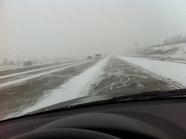
For a while, just a while, I, in my fluffy little Hyundai Accent, managed to drive at speeds up to 50mph. That didn’t last too long. By the time I availed myself of the rest stop at Menomonie WI, conditions were deteriorating quickly.

This is the mayhem that I was endeavoring to traverse, from the upper left pin to the lower right. Kindly disregard that one in the middle that’s out of line.
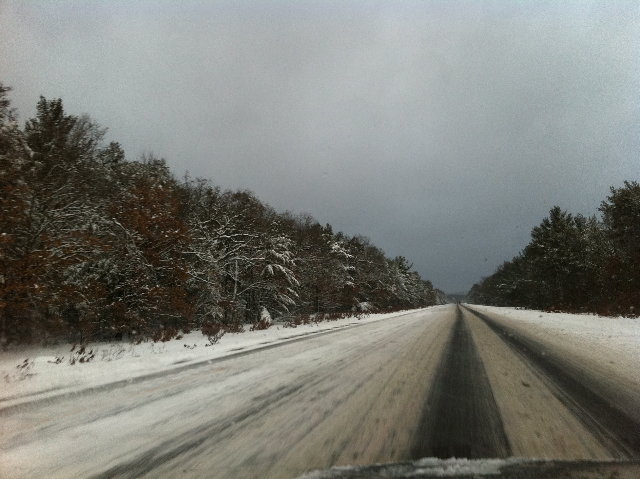
As I neared Eau Claire WI, conditions were approaching white-out (I refuse to spell it Wite Out®). What qualifies as white-out? At best, I could see 1/10 mile ahead of me. At the second Eau Claire exit, traffic was diverted off of I-94 to US Highway 12. Tonight I heard it was because of a twenty-car pile-up. At the exit, there were four vehicles in either ditch. I shall now digress and editorialize about something that irks me at the best of driving times—tailgaters. It’s bad enough that when you’re flying down the freeway at speed, people think it’s okay to ride ten feet off your bumper. Today, in the blizzard+white out conditions, people were riding ten feet off other people’s bumpers. What in the name of [insert your favorite diety here] makes you think that’s a good idea when it’s slippery and you can’t see anything? Your tailgaiting me makes me go slower, not faster. It’s counterproductive. It’s a blizzard, for [x]‘s sake. Don’t be a fucking ass because you drive an SUV. Other people don’t. I understand the limitations of my particular car and drive accordingly. It’s not a winter car. I had no business being on the road today. But since I foolishly chose to be so, I drove within the parameters that it is capable of meeting under such conditions. You’re just going to have to wait for me, or use the other lane to pass me. Your tailgating is not going to make me drive in a manner that my car can’t handle.
So we got shunted onto Highway 12, and I stopped at the next gas station to use the facilities and to clear the ice off my windshield wipers. The passenger side one had been caked with ice since shortly after the Menomonie rest stop and my driver’s side was almost holding its own, but every now and then I had to open my window and grab it and try to smack it against the windshield as it made its pass.
The nice lady at the gas station recommended taking 12 to Wisconsin 53 to Osseo WI, where there is a big junction with I-94. It was while driving on 53 that I realized that was the way to go. The road surface may have been less clear than the interstate, but I had more confidence in it, and I quickly realized major advantages. On the less major roads, there was far less traffic, and trees, property, and any other stuff is closer to the road which allows you to more easily keep your bearings during blizzard driving, and it provides more interesting viewing while you’re driving so you don’t get fatigued by white white white white. I was delighted once again by Mother Nature’s beauty.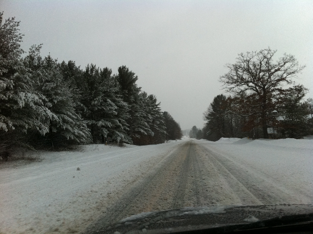

I took 53 to US 10 just west of Osseo, where I stopped at the SuperValu for the bathroom and a snack. I decided to stay off I-94 and rejoined Highway 12 about ten miles further east. The snow began to ease and the clouds became less thick, and for a while, there were some really interesting quality of light things going on. I don’t know if these photos do it any justice.

At Black River Falls WI, I decided to get back onto I-94. The lanes were pretty clear and I was fairly confident pushing the needle to 40–45mph. Quality of light continued as I moved into the “wintry mix” portion of the weather. Thundersnow was forecast for south-central Wisconsin. The clouds were alternately thick and dark, and looser with the sun almost poking through.


Shortly after Black River Falls, there was a rest stop at which I paused. Just as I pulled in, it started to hail. Okay, so it was really tiny and probably technically large sleet, but I’m calling it hail. They were very discreet, peppercorn-sized balls. I took the opportunity to eat one of the sandwiches I had packed. I’m very glad I packed sandwiches.
Well, within about half an hour, darkness began to settle on the situation. I passed Tomah WI and began to have thoughts of hitting up California Rob’s Madison brother for a place to crash, because it was becoming apparent that it would be after midnight by the time I got to Chicago, or fourteen hours on the road in stressful conditions. I tried to push on in the darkness, but it rather quickly became obvious that with the liquid precipitation that was now falling which was likely freezing rain, and all the semi-trucks that were whizzing past me in the left lane, temporarily blinding me each time, I was operating under very unsafe conditions and was rapidly becoming fatigued. I decided I couldn’t even make it to Madison and exited at the next lodging opportunity, which was Mauston WI, which is from where I’m now writing to you.
I had a reservation at a Super 8 in Chicago, so that’s what I chose in Mauston, hoping I could transfer tonight’s booking here. Because of the extremely cheap rate, I couldn’t do that and had to pay here, too, but no matter. What’s my safety worth? Certainly more than the cost of a hotel room. And it’s a really nice room, too, well worth the $55 (my Chicago rate was $43).


However, unlike its neighbor, the Country Inn Suites, it does not have a bar. So I went next door to DJ’s, and hung out for a while. Though I could have chosen the 16-ounce cans of Keystone Light for $1.50, I instead opted for the $3 Hacker-Pschorr Weiss and $3 Guinness Draught. I brought two cans of Guinness back to the Super 8 with me, which I have enjoyed while recounting my tale. So that was (ahem) five beers and a frozen pizza for $20 plus tip.
My safety, priceless. I will forge ahead in daylight tomorrow.The day in walk: Bridges 2: winter riverfront
January 17, 2011
Today I was supposed to pick someone and follow them for a while, reporting on where they went. Well, I followed Old Man River and he went south, to New Orleans.
I was going to take pictures of the river (the Mississippi River in downtown Minneapolis)—the river itself—but it didn’t take long at all for my focus to shift to the bridges. The river is present in a few of the shots, but once again the underneaths of the bridges are the stars. Maybe you remember when I did that last summer on a bike ride.
Ah, summer.
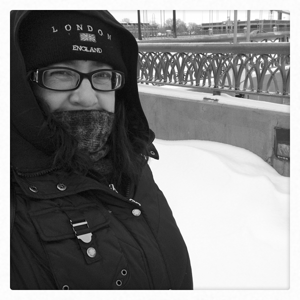
The difference between last summer’s bike ride and today’s walk is, oh, I don’t know, about 70°F/21°C. I didn’t look today, but it was about 15°F/-9°C, based on the forecast high. But being a hardy Minnesotan, I bundled up and went for a nice walk.
So.

1. Hennepin Avenue Bridge (historic). Underneath the bridge, behind where I stood to take my photo, are a couple of pylons from the original version of this bridge built in the mid-1800s. I think the current bridge is the third or fourth version. Oh. According to Wikipedia, this bridge was the first permanent one across the Mississippi River. How about that?

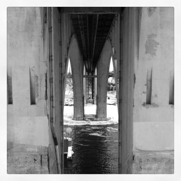
2. 3rd Avenue Bridge (secret passage). Just a bit east (the whole walk wasn’t even two miles), is a more modern-looking, but quite older bridge. This one was an odd duck because it has beautiful arches when viewed from a distance. But when you’re standing directly underneath it, all you see are two doorways like the one in this photo. It looked like it went through three parallel walls. Weird. I was sort of disappointed there wasn’t a drawbridge or something.
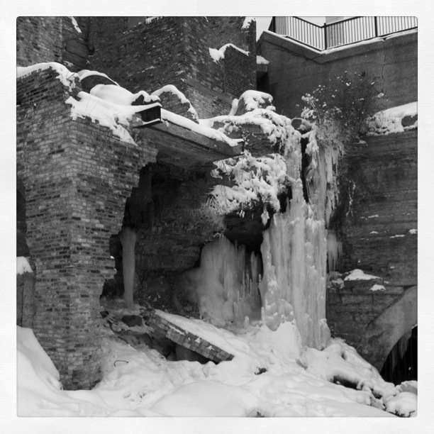
3. Mill Ruins Park. Okay, so it’s not a bridge, it’s the riverfront ruins of abandoned flour mills. There is running and dripping water everywhere. The icicle mass was cool. There also seemed to be a model photoshoot going on. The models were not modeling outerwear. Silly catalogs.

4. Stone Arch Bridge (arches). This is the bridge that might possibly have some notoriety outside the Twin Cities. It used to be a railway bridge. Now, it is for pedestrians and bicyclists. It’s stoney and archy and neat. It’s at the foot of the St. Anthony Lock & Dam, which I believe is the first lock and dam on the Mississippi. The first in sequence, I mean. I don’t know if it was the first constructed.
5. I-35W Bridge (strong). This is the sturdy replacement for the bridge that collapsed in 2007. From the side you see graceful arched spans, and from underneath you see these stout legs. I live in the neighborhood. I was outside puttering with my tomato plants when the old bridge collapsed. I heard the sirens and figured there was a big accident on I-94, which is also near my home. It’s still weird to interact with the new bridge.
6. 10th Avenue Bridge (industrial). It’s also weird to be underneath this bridge, just a couple blocks downstream from the 35W Bridge. This photo doesn’t show it, but this bridge looks old and tired from below. The roadbed on top is all spiffy, but it’s a little creepy to look at the chipping concrete when you know what happened to its neighbor three years ago.

Photos were taken with the assistance of my new friend, Instagram, and the Inkwell filter. (Except for the first one of me, that is. I did that in Photoshop.)
The night in bus ride: home from work
December 18, 2010

I was supposed to ride a route from start point to end point and document, but I misunderstood. So instead, I simply got home from work.
I wanted to take the 7 because it picks me up right outside of work and lets me off right outside of home. Unfortunately, I went to this stop which was half a block away from the office in the wrong direction from where the 7 actually stops. At first (second), I thought I’d get on this 50 but there were too many other people getting on.
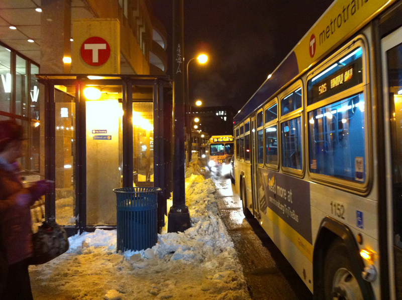
Besides, a 3 was right behind it, which goes the same way as far as I needed to take it.
So I got on it instead.

There were fewer people. That made me happy.
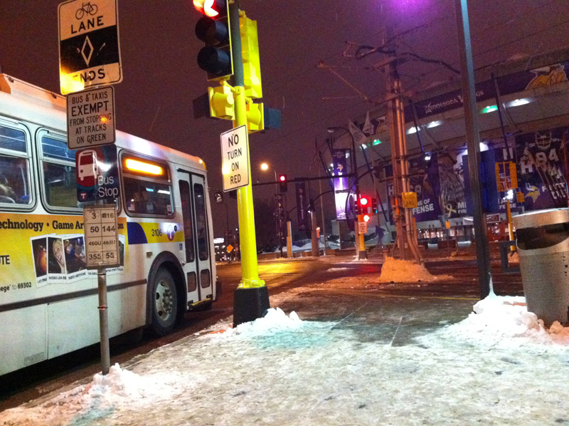
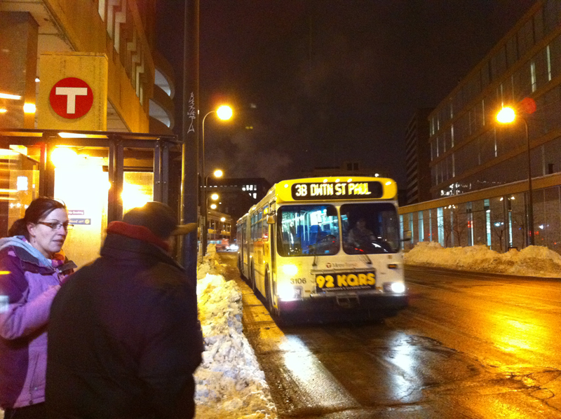
The 3 and I parted ways at the Metrodome. The poor, deflated Metrodome. Ah, now you’re paying attention. There’s no puff on the top, is there.

Unfortunately, neither the 50 nor the 3 go right to my mid-ride stop, so I had to walk about a quarter mile to get to Sorella for an informal wine tasting.
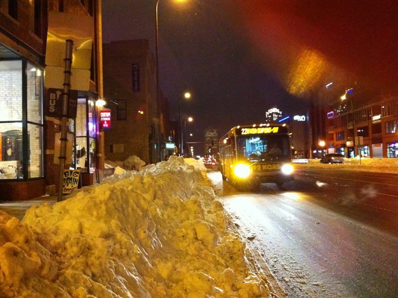
The wine tasting didn’t really take that long, so I had a while to wait for my transfer, which would now be the 7, or the 22. Either one deposits me satisfactorily close to home. Here comes a 22.
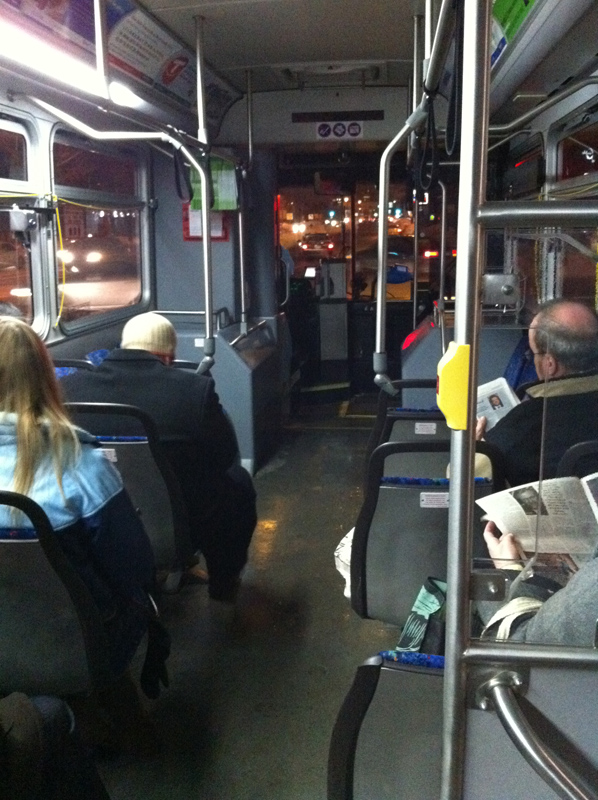
There were a few more people on the 22 …

… including me!

And, home. Astute friends will notice Palmer’s Bar just ahead.
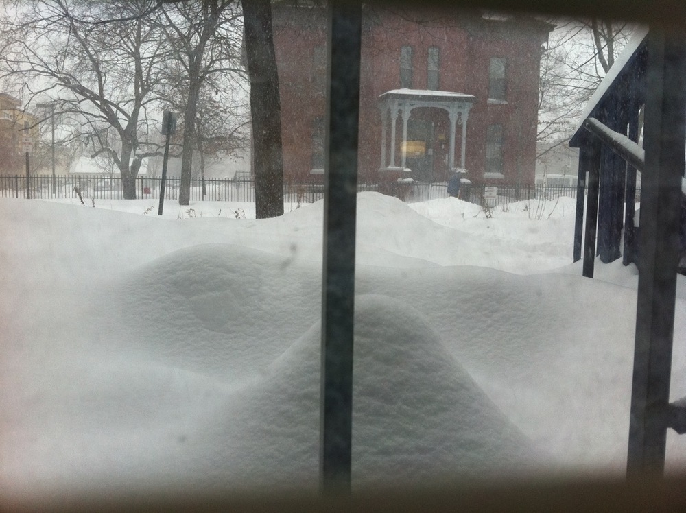
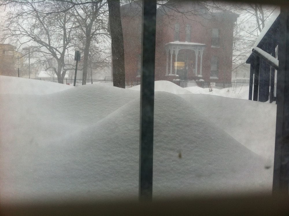
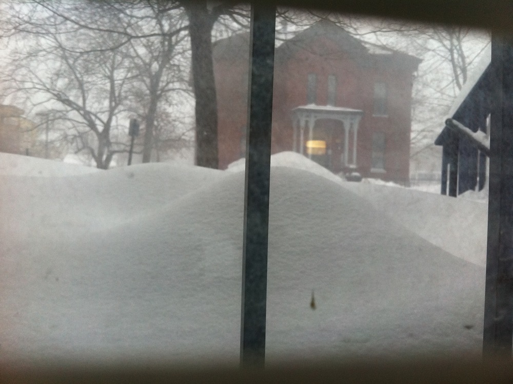
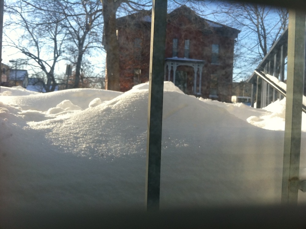
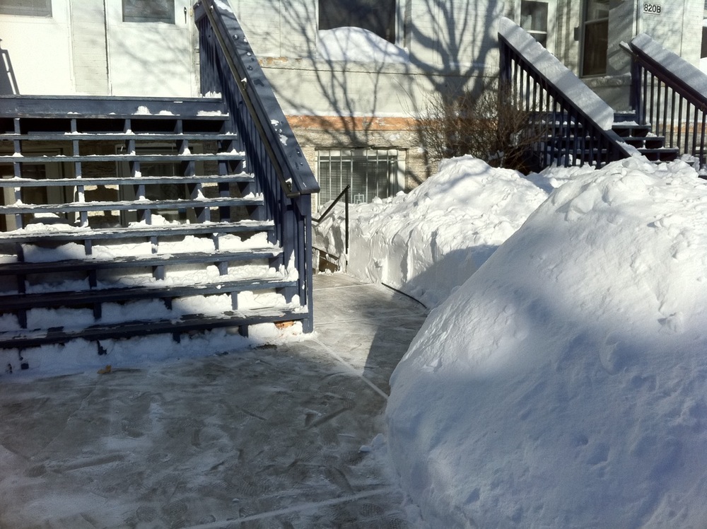
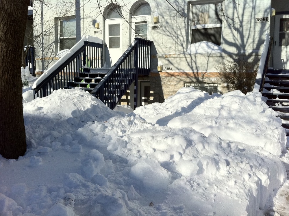
The day in snow: Blizzard 12-11-10 (photos)
December 13, 2010
It snowed! Here are the photos; check out the few videos, too.


Friday night as the snow started around 10:13pm. If you look closely, you can see rabbit tracks crossing the sidewalk. I think one lives under my neighbor’s stairs.


Time lapse:
Saturday at 9:30am, 11:30am, 1:30pm, 3:30pm;
Sunday morning before and after shoveling. I can’t see too much out my window anymore!
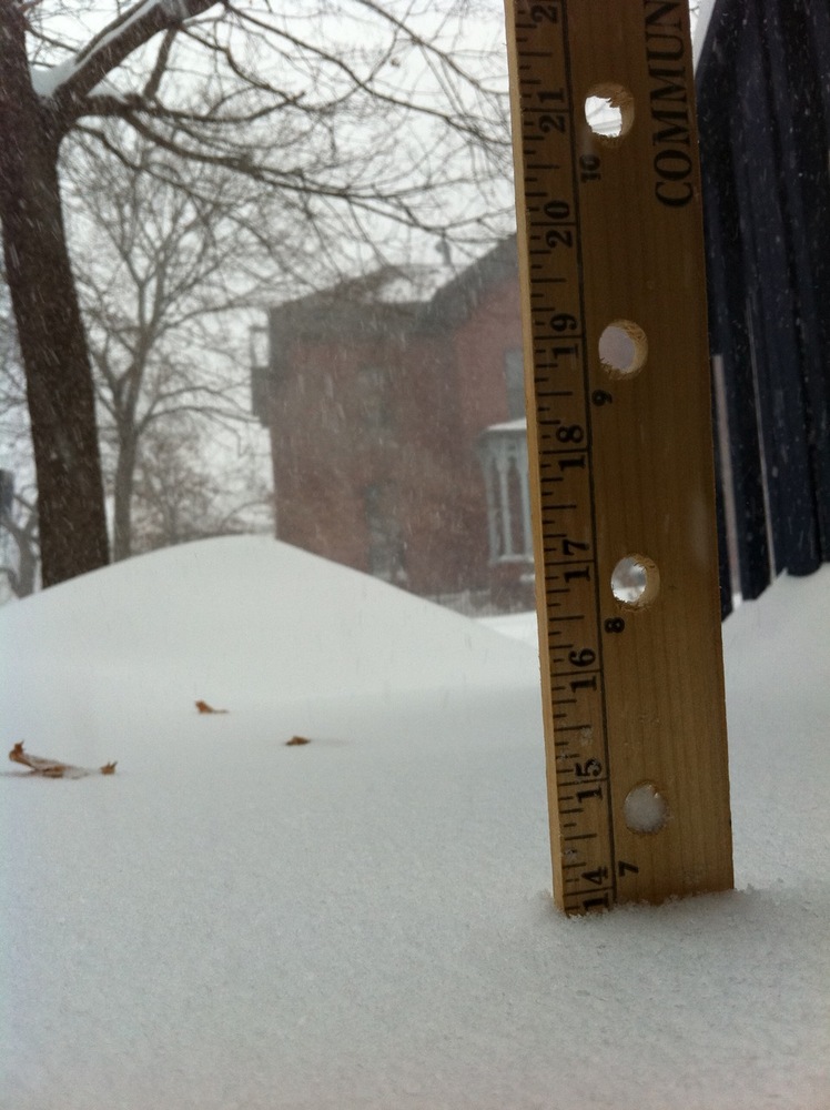

Saturday at 1:30pm 14 inches; at 5:30pm 17.5 inches. That was about the end of the snowfall. Then it got windier.
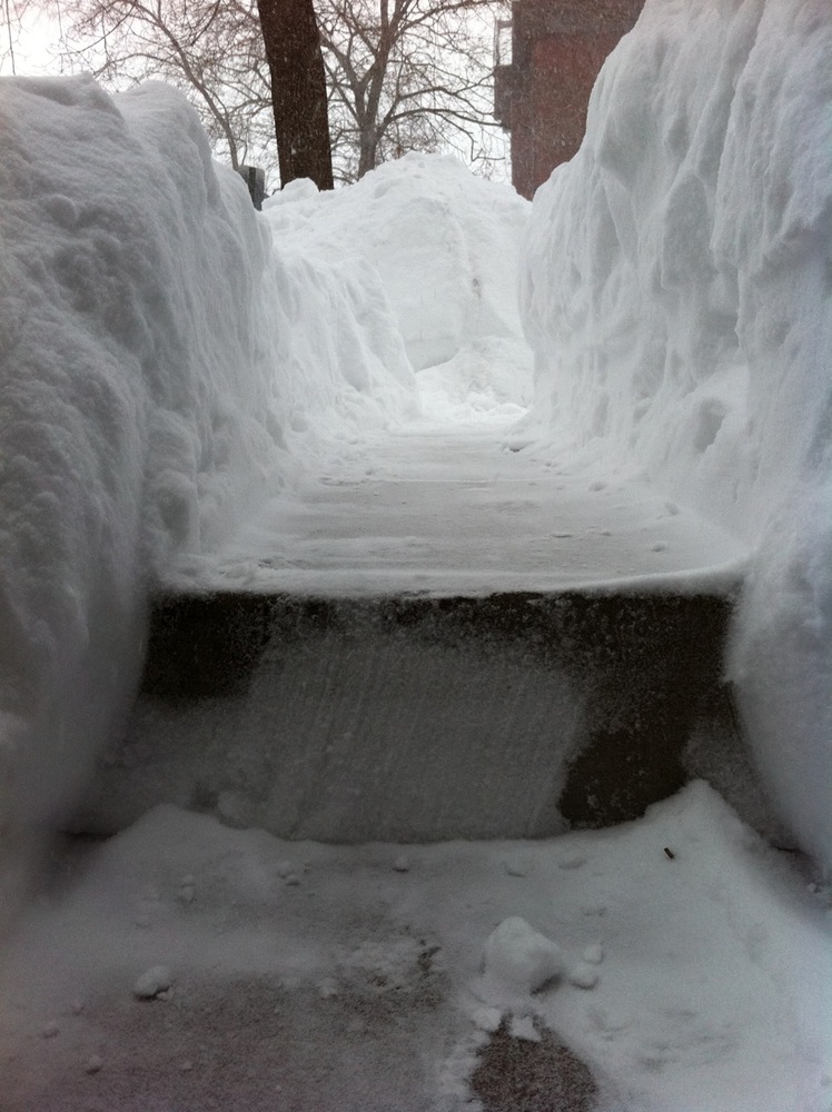
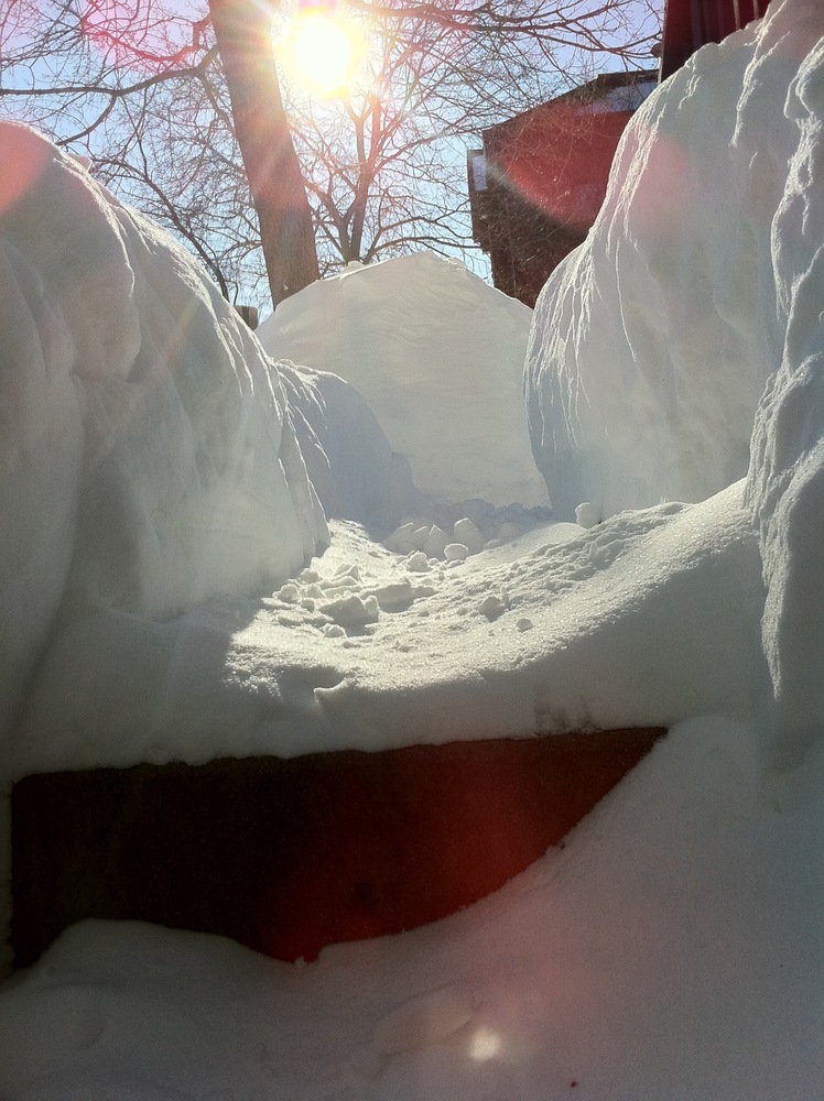

Saturday afternoon I shoveled an exit trail from my garden level apartment. I did it a second time four hours later. It wasn’t too bad Sunday morning after a few more inches and overnight winds. However, it had to get worse before it could get better as I did a thorough removal from my door area, steps, and walk.


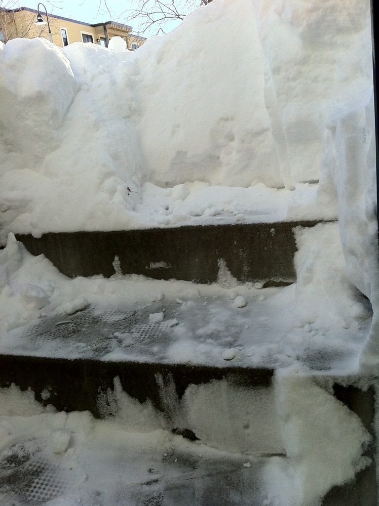
Before and after. I was nice and shoveled my neighbors’ deck and stairs. I figured I could do it tidily myself and minimize the mess below, or be annoyed at having to clean up after them later. I also shoveled my end neighbors’ steps and made a one-shovel-width trail. They’re in Mexico and I bet they’re laughing right now!
Post-shoveling view of my window from the outside.
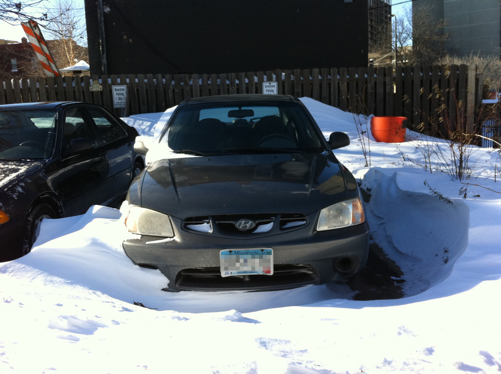

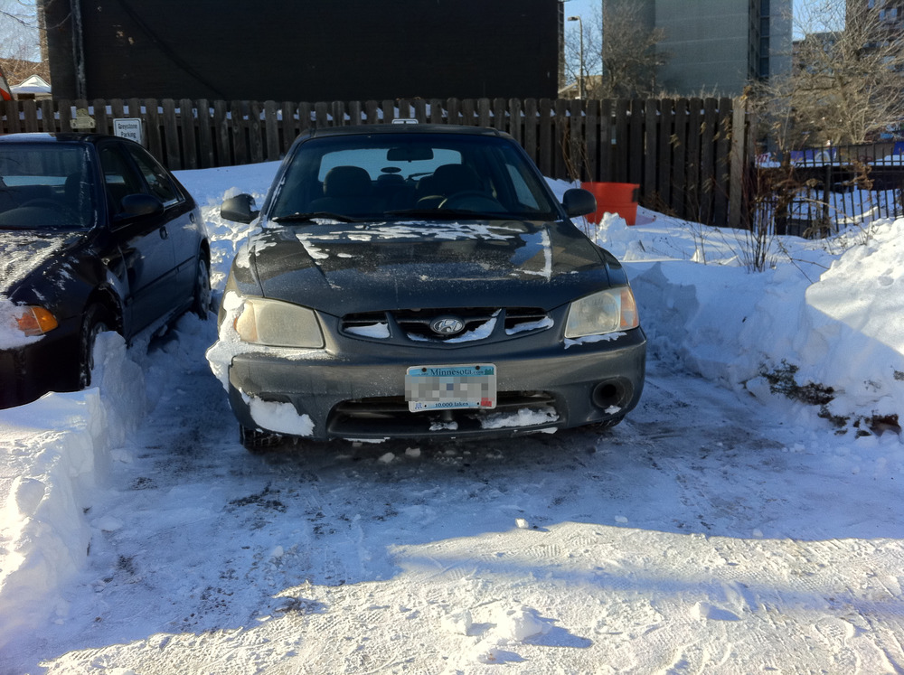
Fortunately, blowing and drifting worked to my car’s advantage. It wasn’t too much trouble to shovel out my parking space. The drift didn’t go very far underneath.


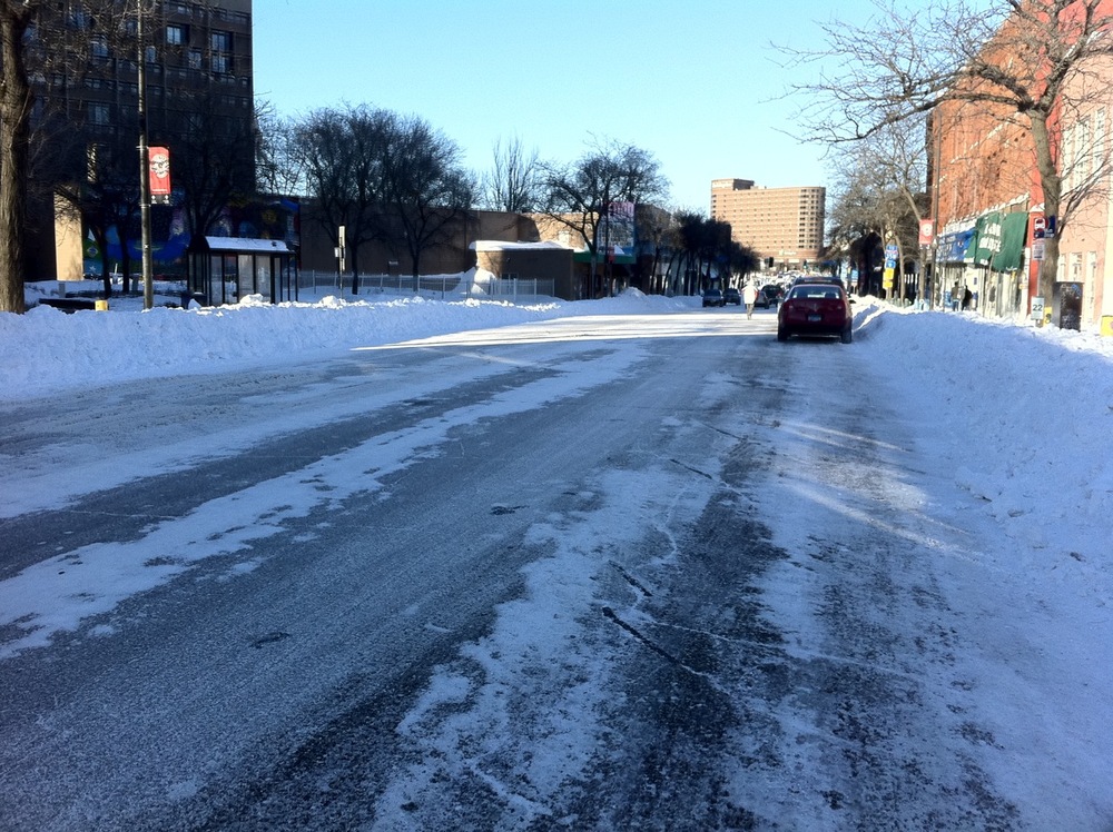
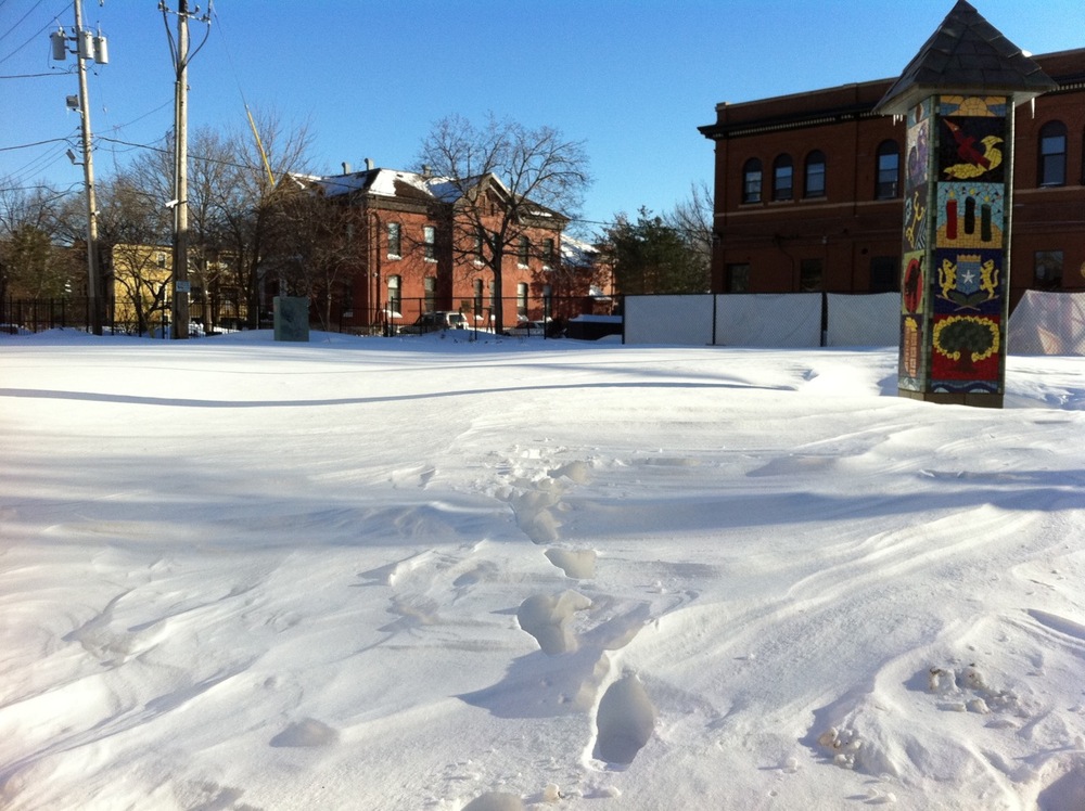
Around the neighborhood: My immediate street has not been plowed yet as of 9:30pm Sunday (it was vacated by the city years ago, so we have a contract with private plowing). The city made one pass through the side street. Snow emergency routes like Cedar Avenue are in pretty good shape. Drifted snow in a nearby vacant lot.
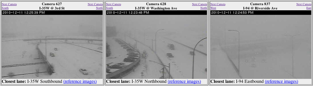
Views from my nearest MNDOT traffic cameras Saturday afternoon during the storm.

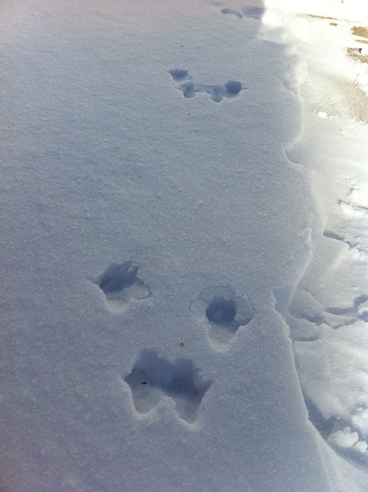
I’ll end with gratuitous rabbit pictures: a neighborhood rabbit frolicked Friday night before the snow started; tracks on a drift in my yard on Sunday.
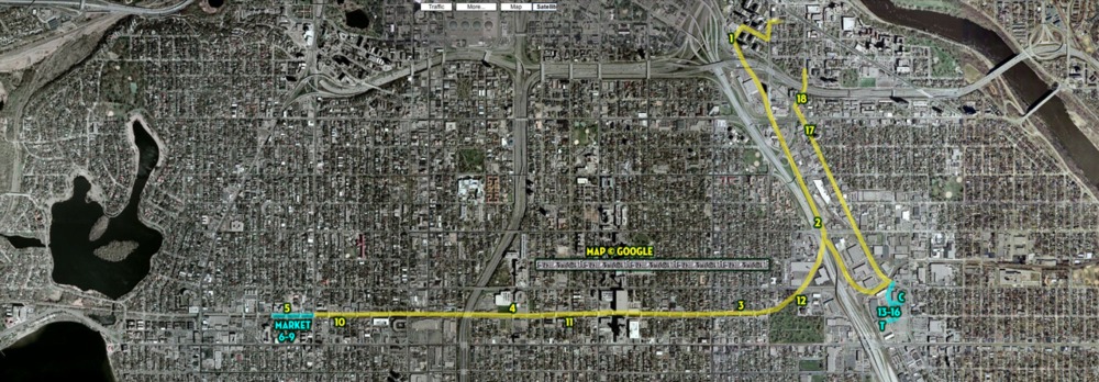
The day in bike ride: September 4, 2010: Bridges
September 5, 2010
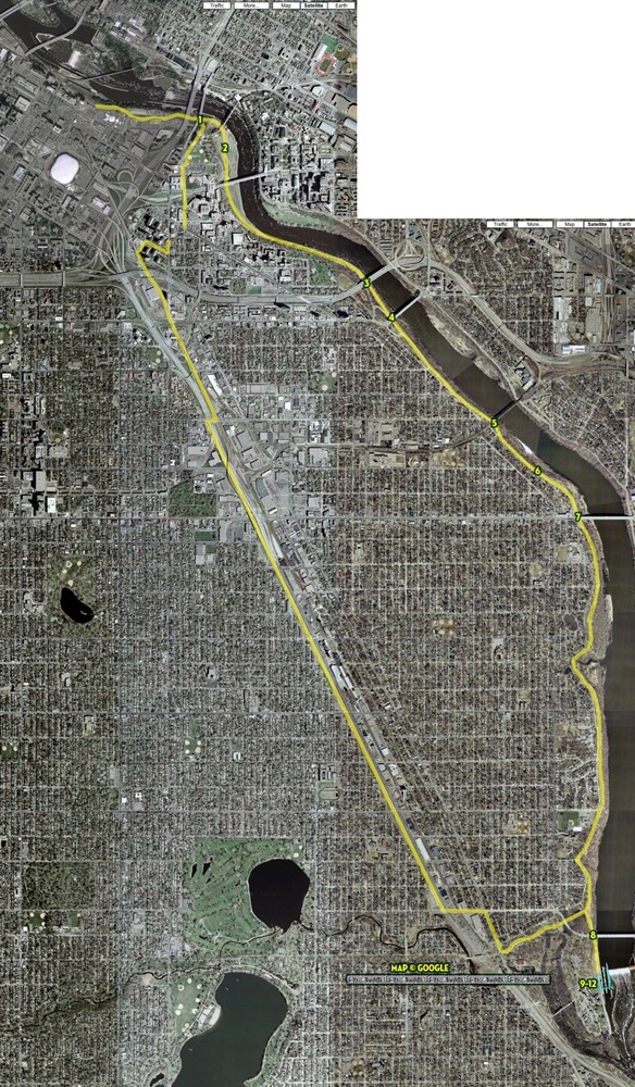
I only intended to go to the Mill City Farmers Market to get something to eat from Chef Shack. I did, and then on my way back, I got a sudden bee in my bonnet to just go on a little bike ride. So I did. And paid attention to the undersides of bridges.
These are all bridges over the Mississippi River between St. Anthony Falls Lock & Dam and Lock & Dam No. 1. There are three not pictured because I didn’t get the idea right away.
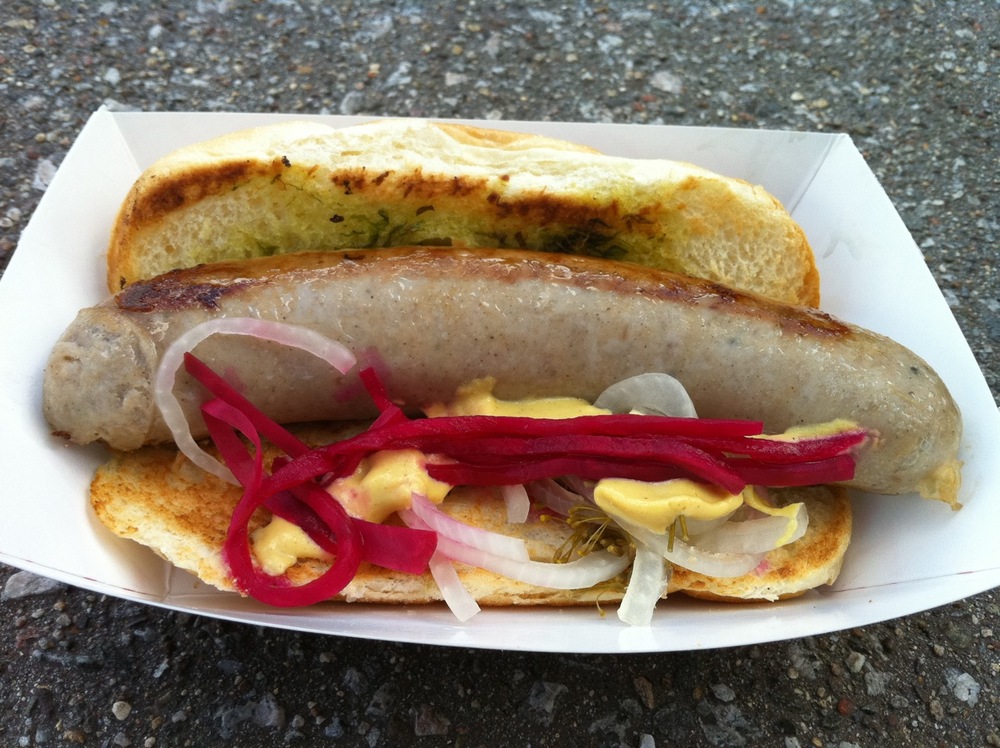
Bridge to nourishment: bacon beer brat from Chef Shack.

Photo 1: 10th Avenue
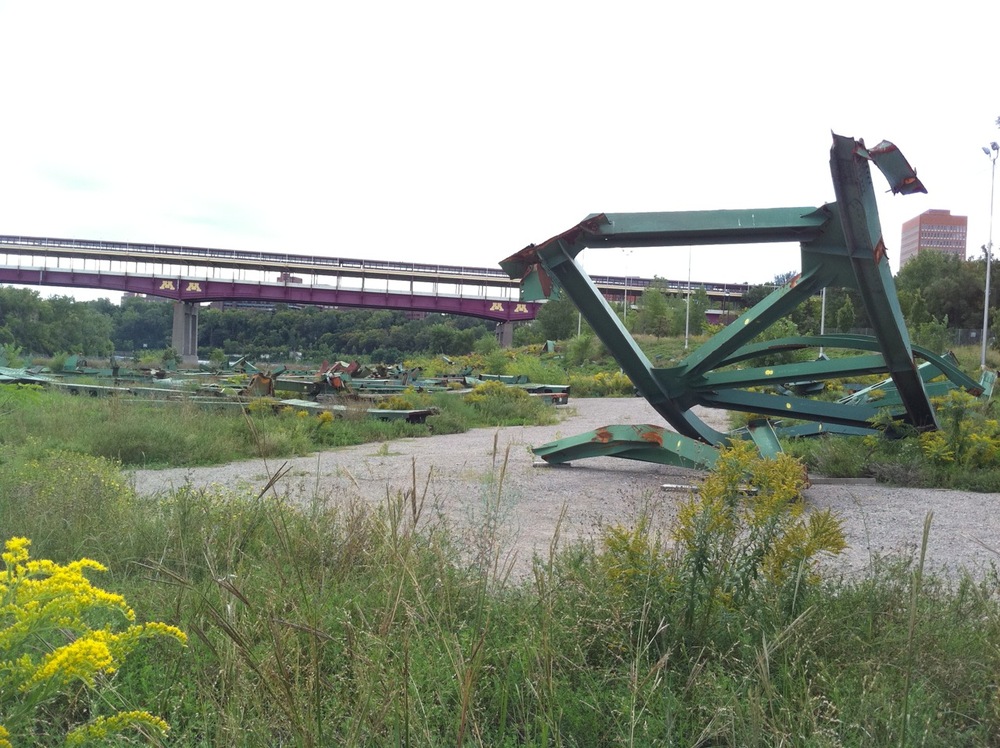
Photo 2: Remains of the I-35W bridge that collapsed in 2007 are still spread out on the Bohemian Flats near the University of Minnesota.
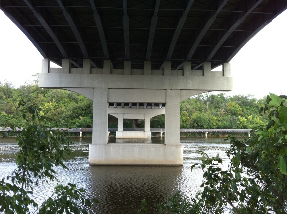
Photo 3: I-94
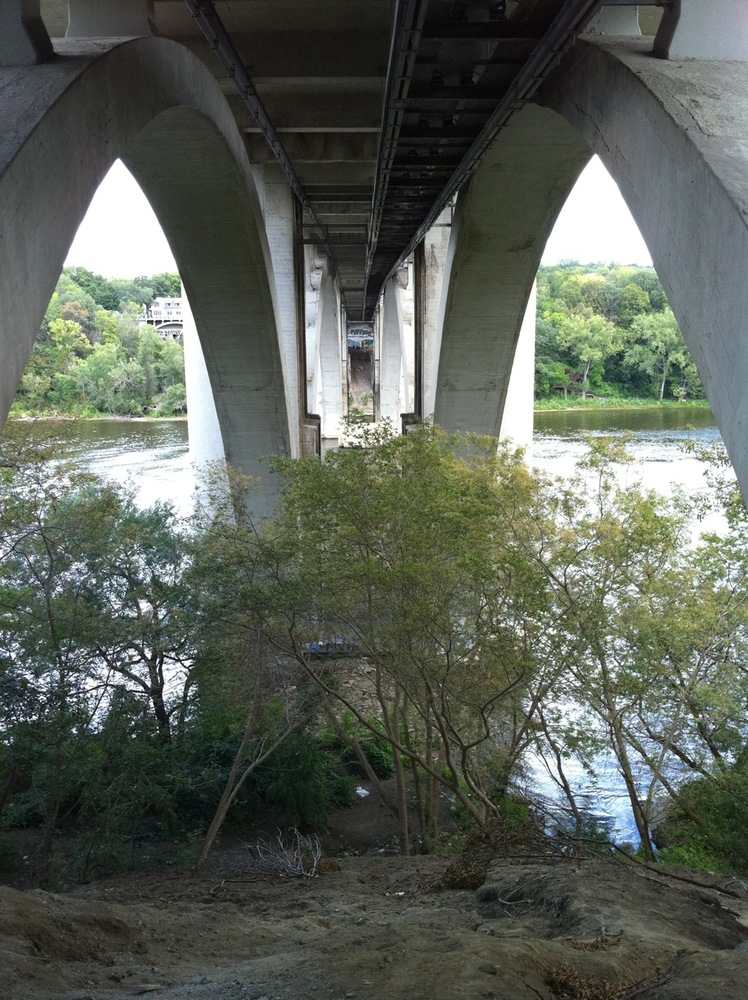
Photo 4: Franklin Avenue
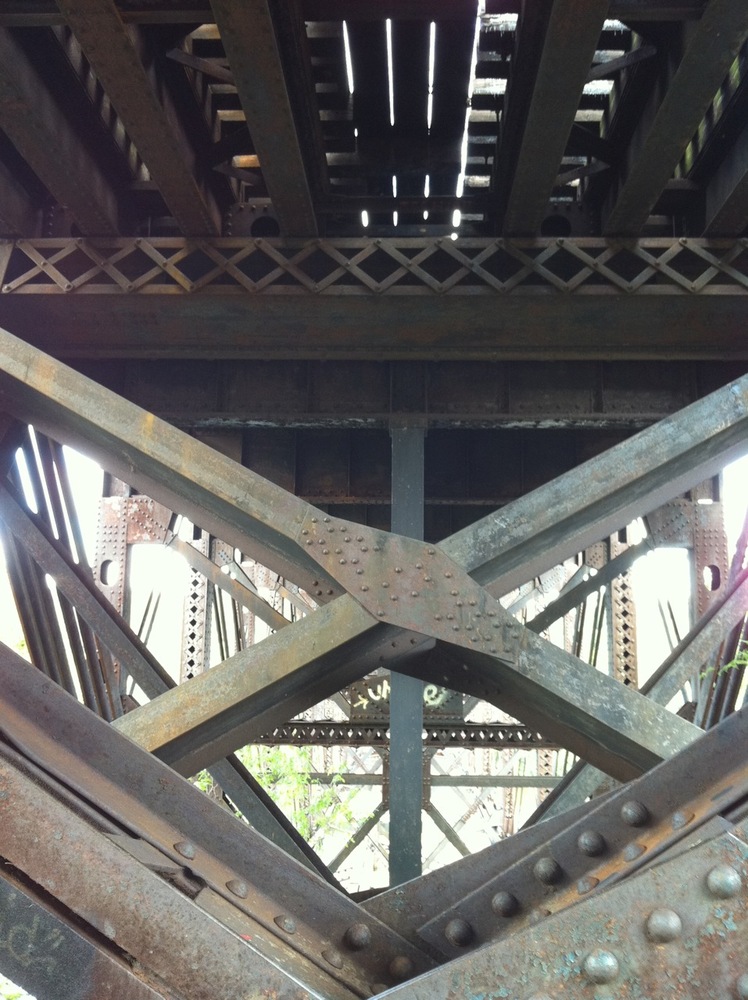
Photo 5: Railroad bridge between 26th and 27th Streets . I would seriously doubt that it’s still used for train traffic.
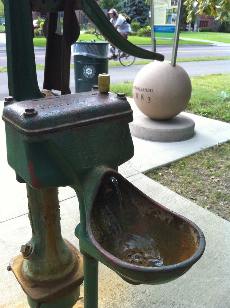
Photo 6: Bridge to hydration
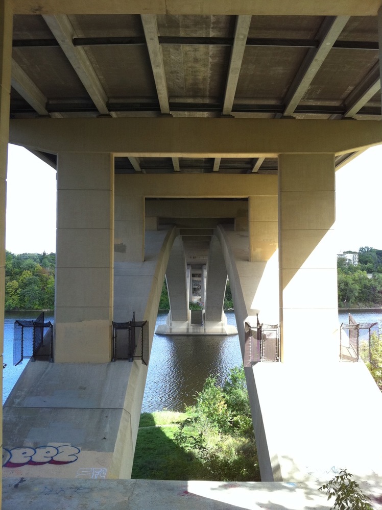
Photo 7: Lake Street
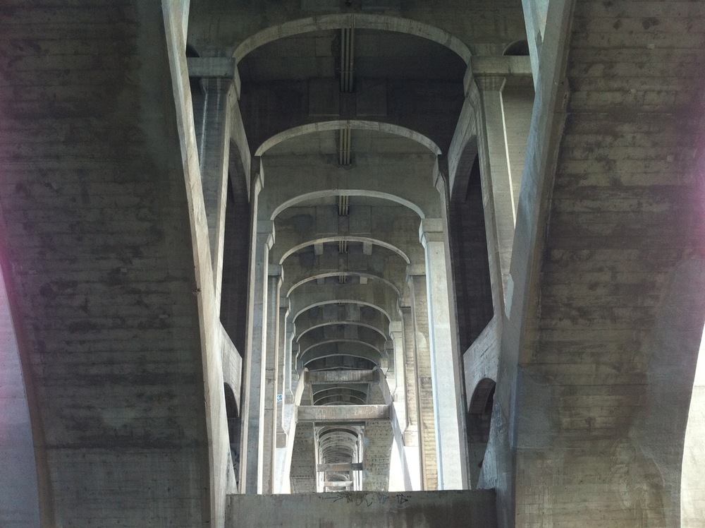
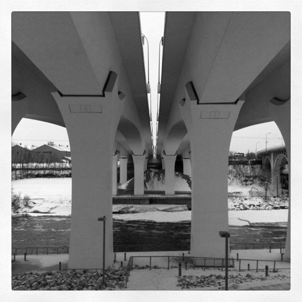
Photo 8: 46th Street. This one seemed quite cathedral-like to me as I stood under it.
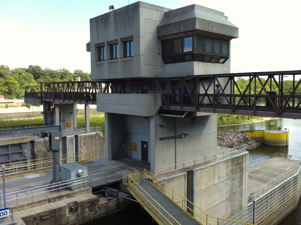
Photos 9–12: Bridge on the Mississippi: Lock & Dam No. 1. I had a little staycation with this as I hadn’t realized that you can walk all around the facility. There is a catwalk that bridges the two locks (it seems only the 9-footer is used), and then it’s quite parklike on the dividers between the various channels.
Photo 9: Bridge to observation, catwalk

Photo 10: The 6-foot lock, which doesn’t seem to have been used any time recently, as there were some quite large shrubs growing in the far end of it on the wall.
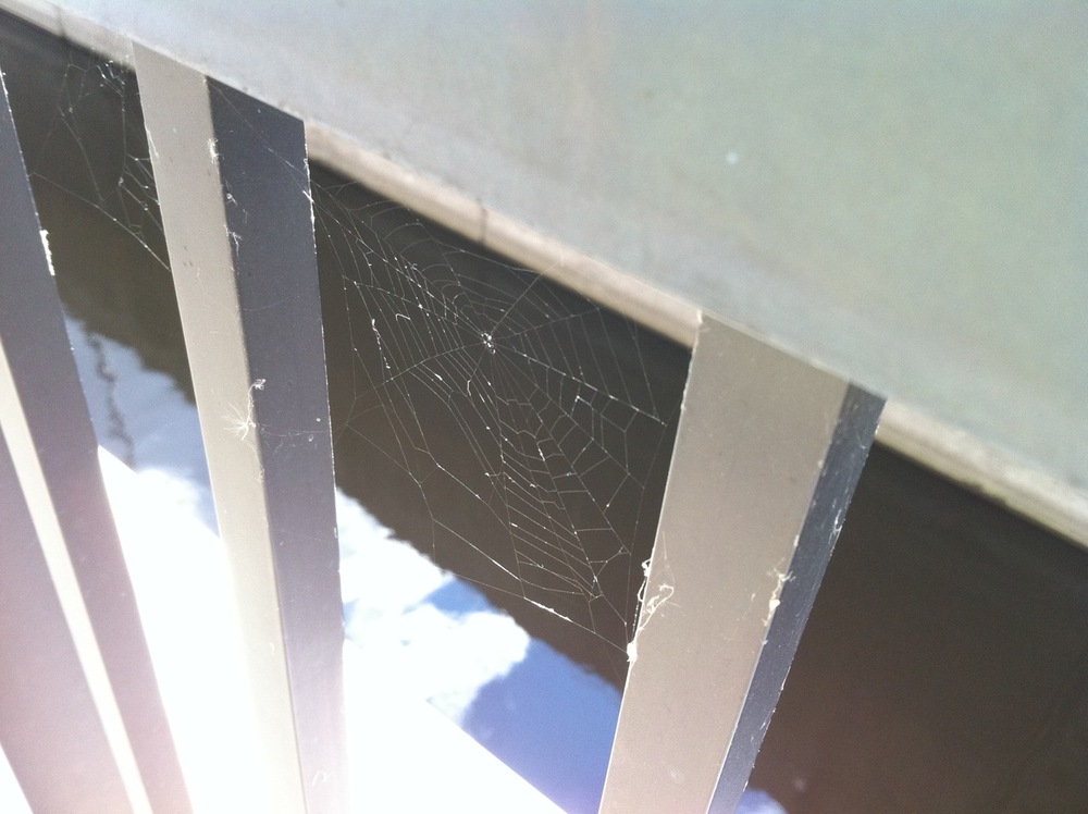
Photo 11: Bridge to dinner, if you’re a spider.
Finally, I leave you with this video of the dam’s waterfall. That’s a blue heron flying around. There were also white herons, ducks, and geese.
There were more bridges on the second half of my ride, but unfortunately, my battery died while I was enjoying the Lock & Dam. Maybe I’ll go out again this weekend to capture those.
The day in bike ride: August 29, 2010, with bonus errands
September 1, 2010
My new big thing is the Chef Shack food truck. It’s two chef gals who make amazing culinary delights. They usually post the menu on Facebook, and Saturday morning they also posted a photo of the charcuterie plate that they had on offer at the Kingfield Market in south Minneapolis.

photos © Chef Shack
I didn’t get myself going quickly enough to get down there by the 1:00 end time, so I instead went to the Uptown Market where they also were (I think they have three vehicles—two trucks and one trailer), figuring I’d get it there instead. The round trip to Uptown is about 8 miles; on the way home I jogged down to the store to pick up some necessary items and that added another couple miles.
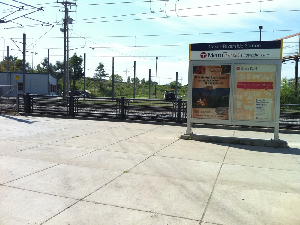
Photo1: entering the Hiawatha commuter trail.
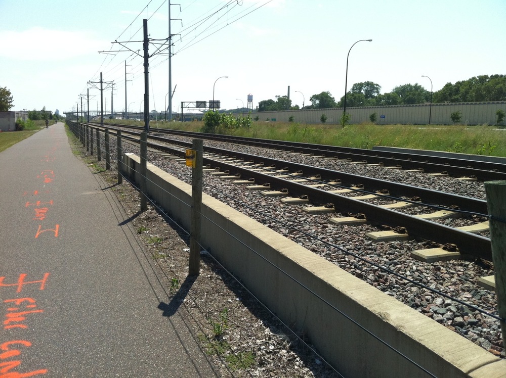
Photo 2: heading southish on the Hiawatha commuter trail to meet the Midtown Greenway.
Photo 3: heading west on the Midtown Greenway at 11th Avenue.

Photo 4: Midtown Greenway at 4th Avenue. Thanks for the heads-up, sign.

Photo 5: Bryant Avenue South and 29th Street. I lived in this apartment building for 11 years. Three blocks along 29th are where the Uptown Market is on Sundays.
Photos 6: The market, looking west.
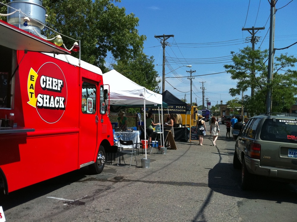
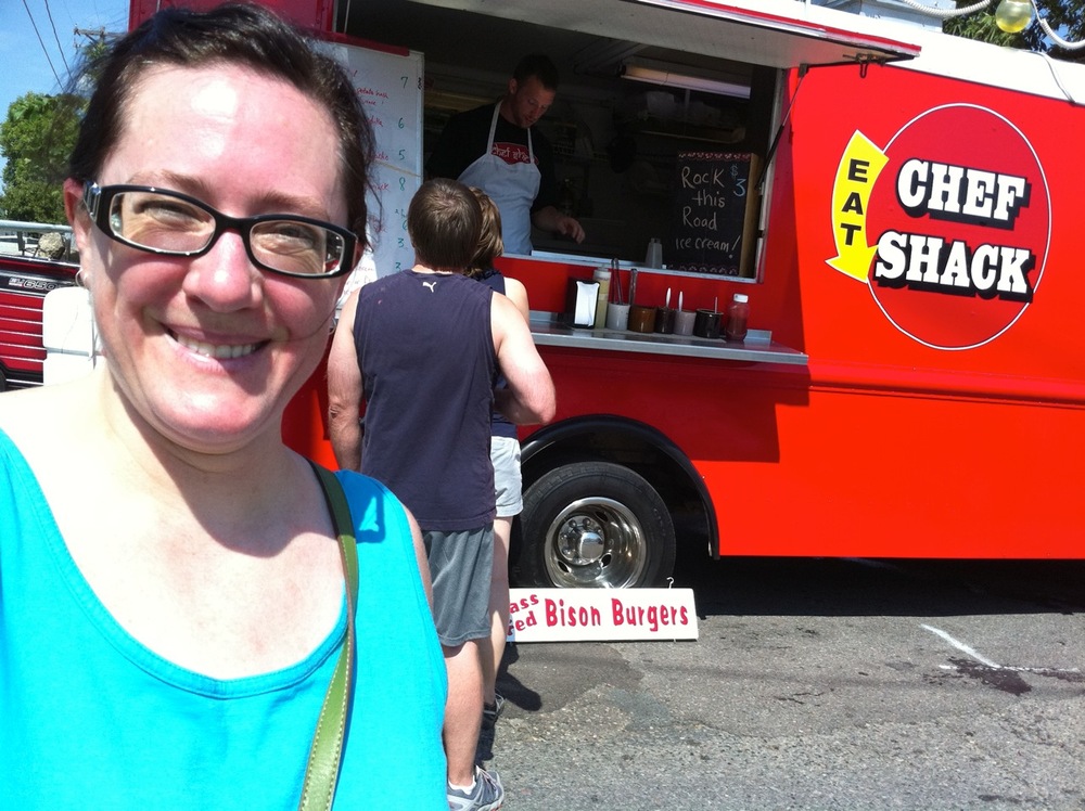
Photo 8: Waiting for my order. It turned out that they didn’t have the charcuterie plate here, so I ordered the bison burger instead.
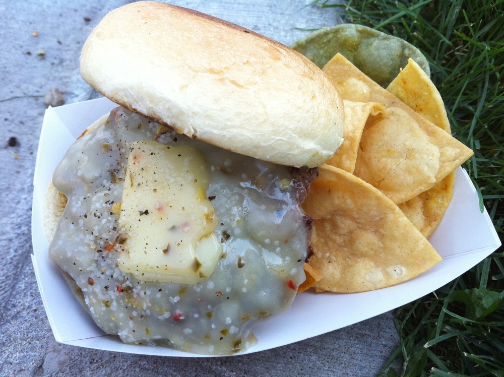
Photo 9: Bison burger with pepperjack cheese and chips. Dining on the curb in the shade. It was quite hot but not too humid so it was just barely tolerable for the exertion of the bike ride.

Photo 10: One of the many gardens along the Greenway, at Harriet Avenue South.
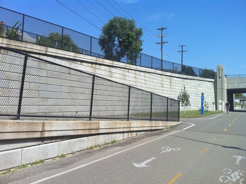
Photo 11: Heading back east along the Greenway. Access ramp at Park Avenue South.

Photo 12: The Greenway jogs north across 28th Street to cross the busy Hiawatha Avenue/Highway 55.
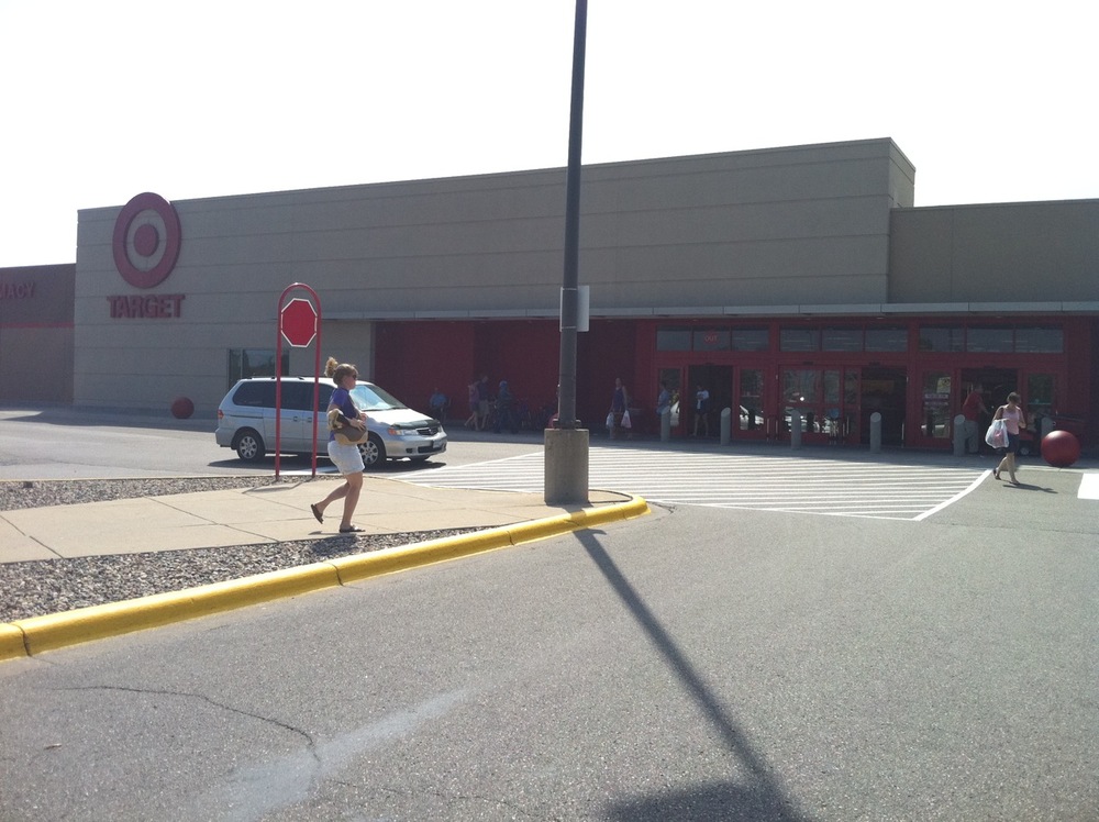
Photo 13: Target. Errand stop number one.

Photo 14: Cub Foods. Errand stop number two.

Photo 15: Cheese!
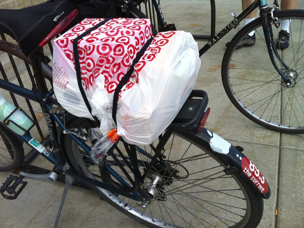
Photo 16: All items procured. I think this will work.
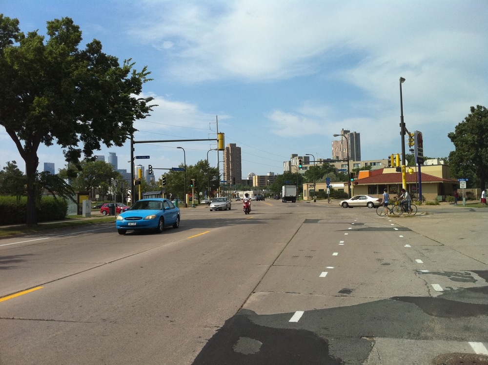
Photo 17: Approaching the weirdo intersection of Minnehaha, Franklin, and Cedar Avenues.

Photo 18: 20th Avenue, just about to cross Interstate 94. The home stretch.
